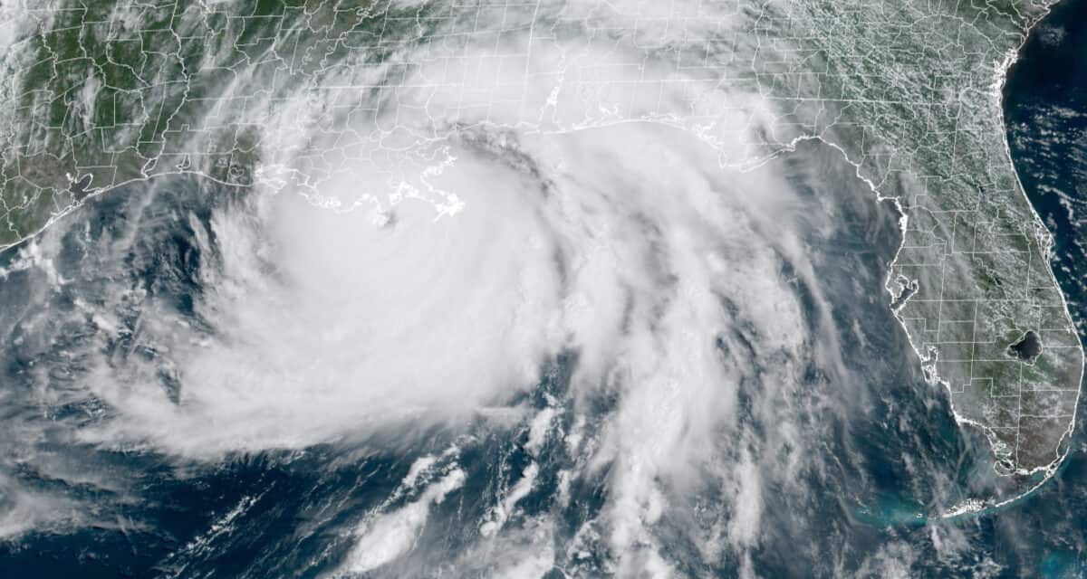
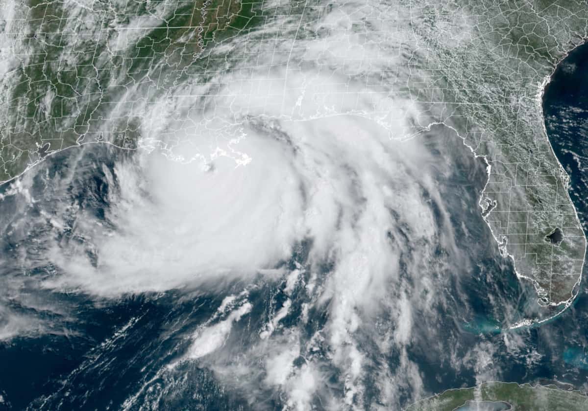
Hurricane Ida at Category 4 Shortly Before Landfall on Southeast Louisiana. Ida destroyed the SE Louisiana Power Grid and all 7 main transmission lines leading into the region. Utilities had to isolate the region and use two local power plants to supply hospitals and first responders. NOAA Satellite Image.
Second Consecutive Season Exhausts All 21 Storm Names
The 2021 Atlantic Hurricane Season turned into the third-most active on record. With the development of Tropical Storm Ana on May 22, it became the seventh season in a row for a named storm to develop before the official June 1 season start. It was the fourth most-costliest season on record with estimated damages exceeding 70 billion dollars. It was also the most active June on record with three Tropical Storms—Bill, Claudette, and Danny.
2021 exceeded early estimates. Early discussion noted the possibility of 16 named storms in 2021 including seven hurricanes. In April, Colorado State University’s Tropical Meteorology Department issued its first forecast for 17 storms, eight hurricanes, and four major hurricanes. Higher than normal Atlantic Surface Seas Temperatures (SSTs), the unlikelihood of a El Nino forming were factors in the CSU forecast. It later updated the forecast to 18 storms.
As of November 30, the season produced 14 tropical storms and 7 hurricanes, of which 4 were major hurricanes. Tropical Storm Wanda produced a nor’easter before it became tropical storm.
Subtropical Storm Ana Forms Before Season Start
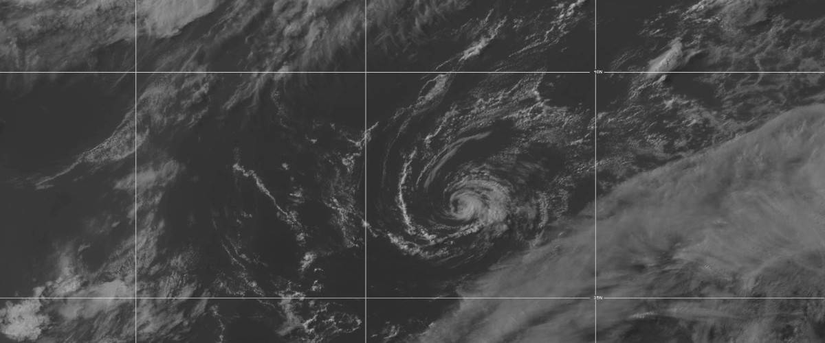
Tropical Storm Ana formed on May 22 out of a strong extratropical cyclone in the mid-Atlantic to the southeast of Bermuda. The cyclone first traveled northeast with an upper level low while producing gale-force winds. By the 21st, the wind field had expanded to more than three hundred fifty miles. The cyclone escaped the upper level and began to develop convection as a subtropical storm and was named Ana on the 22cd. It made a loop to the north and northwest while it transitioned to a tropical storm with 45 MPH winds before moving once again to the northeast.
Increasing wind shear ripped the storm of its tropical characteristics and it once again became a extratropical cyclone. Ana merged with a trough on May 24 and was absorbed by a frontal system that day.
Ana had minimal impacts. Bermuda issued a tropical storm watch on the 20th and discontinued them on May 22.
Third Busiest June on Record
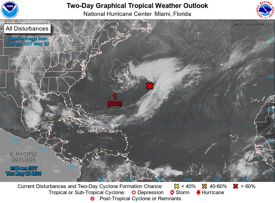
The system that would form Tropical Storm Bill as seen by satellite on June 20, 2021. NOAA Satellite Image
June is typically not an active month. In 2021, June saw the formation of three tropical storms which tied it for the most active June with 1886, 1909, 1936, and 1968.
Tropical Storm Bill formed out of a low-pressure system that originated off the coast of South Carolina. A tropical depression formed southeast of Cape Fear, North Carolina. It strengthened into Tropical Storm Bill on June 14 in an area of high wind shear. Maximum winds of 65 MPH were noted on June 15 as Bill moved parallel to the East Coast. The northeast track took Bill over colder waters. It transitioned to an Extratropical Cyclone on June 16 and dissipated 6 hours later before reaching Southeastern Newfoundland.
A potential tropical low in the Gulf of Mexico on June 11 produced heavy rainfall over southern Mexico and Central America. It began to form some circulation over the Bay of Campeche before moving north as Potential Tropical Cyclone Three. Although it developed tropical-storm force winds, it lacked any well-developed circulation. Not until after making landfall on Southeast Louisiana did the storm take on tropical characteristics—a rare event—and became Tropical Storm Claudette. After weakening to a depression over Mississippi, it moved northeast and regained tropical storm strength over North Carolina—another rare event—before moving over the Atlantic Ocean.
Claudette brought heavy rain across the southeast United States with tropical storm force winds while spawning several tornadoes. The storm killed fourteen people in Alabama. It dissipated on June 22 over the Atlantic Ocean.
Tropical Storm Danny began to form on June 27 with closed, low-level circulation over the Atlantic to the southeast of South Carolina. A depression formed and twelve hours later strengthened into a Tropical Storm. It reached peak strength with 45 MPH winds. At landfall, it became South Carolina’s first June storm since 1867. It weakened rapidly and dissipated over Georgia on June 29. Danny was blamed for minimal damage including minor flash floods and downed trees.
July—First Hurricane of 2021 Season
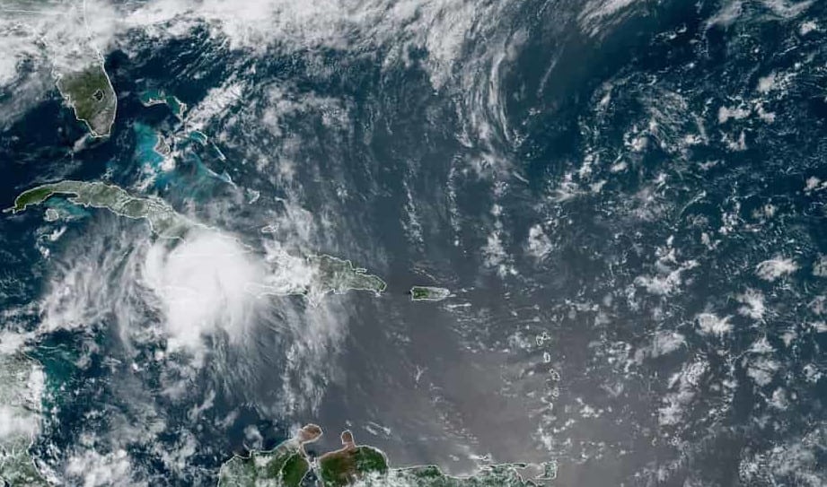
Category 1 Hurricane Elsa Approaches Cuba on July 4, 2021. NOAA Satellite Image.
As Danny dissipated on June 29, the National Hurricane Center (NHC) monitored a tropical wave some 800 miles east of Cape Verde. On June 30, advisories were issued on Potential Tropical Cyclone Five. It became a Tropical Depression on July 1 and strengthened throughout the day to become Tropical Storm Elsa. Elsa became the earliest fifth named storm on record, beating out Edouard (July6, 2020) by five days.
On July 2, the NHC upgraded Elsa to a category 1 Hurricane, the eastern-most hurricane on record in the main development region and the fastest at 29 MPH. Hurricane Elsa weakened to a tropical storm on July 3 as it slowed down and entered a region of wind shear. After making landfall on Cuba and then entering the Gulf of Mexico, Elsa strengthened to a hurricane but lost strength due to dry air. It continued to weaken until making landfall on Florida, but the center stayed over water. It later dissipated over Massachusetts on July 9.
Best Portable Generator for Home Use
Hurricane Elsa caused extensive damage on the island of Barbados and killed one person in Florida. Five more people were killed in the Caribbean. The storm caused 1.2 billion dollars of damage.
Elsa was the only named storm in July. Three tropical waves coming off the coast of Africa would develop in early August.
7 August Cyclones as Season Peak Approaches
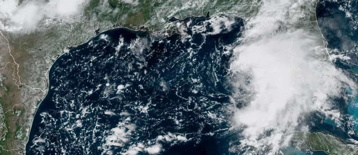
Tropical Storm Fred developed on August 10 over the northeastern Caribbean Sea south of Puerto Rico and made landfall on the Dominican Republic with 45 MPH winds. After several Caribbean landfalls, it entered the Gulf of Mexico and headed north. Maximum winds reached 65 MPH.
Fred made landfall at Cape Blas, Florida and became a tropical depression over Alabama. It travelled north as a depression all the way to Tennessee and degenerated into a low as it headed for Pennsylvania. It finally dissipated over Massachusetts on August 20. Over 800 homes were destroyed in Santo Domingo. Tropical Storm Fred created 31 tornadoes, was blamed for seven deaths, and 1.3 billion in damage.
Prepare Your Home Against a Hurricane
Hurricane Grace started at Potential Tropical Cyclone Seven on August 13 and was upgraded to a tropical storm on August 14. Two days after the major earthquake in Haiti, Grace made landfall as a tropical depression on August 16. The next day it reorganized as a tropical storm and was upgraded to category 1 hurricane on August 18. Hurricane Grace crossed the Yucatan Peninsula, strengthened to category 3 and became the first major hurricane of the season with 125 MPH winds. Grace cross the Mexico mainland, emerged over the Pacific and developed into Tropical Storm Marty. Grace was blamed for 14 deaths and 513 million in damages.
August 15 brought another well-defined low-pressure system about 200 miles from Bermuda. It grew into a tropical depression and 18 hours later became tropical storm Henri. After making a clockwise loop around Bermuda, Henri intensified into a Hurricane Henri on August 21. Just before landfall on Rhode Island, Hurricane Henri weakened to a tropical storm and continued to weaken after landfall.
How to Use a Portable Generator for Hurricane Power Outages
Hurricane Ida formed out of a Tropical Wave over the Caribbean Sea that organized rapidly as it approached Central America. It became the ninth Tropical Depression of the season on August 26. Hours later, an Air Force aircraft found tropical storm force winds it was upgraded to a tropical storm. High Sea Surface Temperatures combined with low wind shear allowed Ida to intensify and become a hurricane on August 27 over a Cuban island. After crossing Cuba into the Gulf of Mexico, it intensified to Category 2 and became better organized. It reached Category 3 on August 29 as it underwent rapid intensification. An hour after reaching category 3, it surpassed category 4. Hurricane Ida made landfall on the Louisiana Coast with 150 MPH winds, just shy of Category 5. The storm traversed the United States with tornadoes in Alabama, Mississippi. It reached Kentucky as a tropical storm and Pennsylvania as a tropical depression.
SE Louisiana & New Orleans Face Weeks Without Power
Ida destroyed the Southeastern Louisiana Power Grid, downing all major transmission lines and toppled a transmission tower into the Mississippi River. Utility workers re-engineered the region to supply critical power needs from two local plants while isolating the region from the rest of the grid. It was weeks before the last utility customers had power. FEMA offered Reimbursements for Generators and Chainsaws.
Ida caused 95 deaths in the United States, 20 more in other countries, and damages totaling more the 65 billion dollars. The storm tracked through the country to New England and exited over Atlantic Canada as a depression.
3 Tropical Atlantic Waves
Another tropical wave monitored by the NHC emerged off Cape Verde on August 23 and developed into a tropical depression on the 28th. On August 30, the NHC upgraded the depression to Tropical Storm Kate. Kate dissipated on September 1 without reaching land.
Before the tropical wave that developed into Kate, another tropical wave emerged off the African Coast on August 20. It formed into a tropical depression on August 28 about the same time Kate developed. The storm was upgraded to Tropical Storm Julian on August 29. Julian became extratropical and then post-tropical storm Julian on August 30 before it dissipated.
On August 27, the NHC began monitoring another tropical wave about to emerge from the African Coast. On August 31, it organized into a tropical depression and further strengthened to 45 MPH winds—Tropical Storm Larry. By September 2, it reached category 1 strength and continued to intensify through category 3, a major hurricane.
When a Hurricane Disaster Threatens
Hurricane Larry went through two eyewall replacement cycles before it began to lose organization and weakened gradually. RIP currents caused by Larry were blamed for two drownings in the United States. Hurricane Larry brought snow to parts of Greenland before it dissipated.
Tropical Storm Mindy formed as a low off the northern South American Coast and followed Central America into the Gulf of Mexico as a depression. On September 8, it was upgraded to Tropical Storm Mindy south of the Florida Panhandle. Hours later, it made landfall on the Peninsula and crossed it to the Atlantic as a tropical storm.
September 10 Season Peak
The Atlantic Hurricane Season Peaks in the period that surrounds September 10.
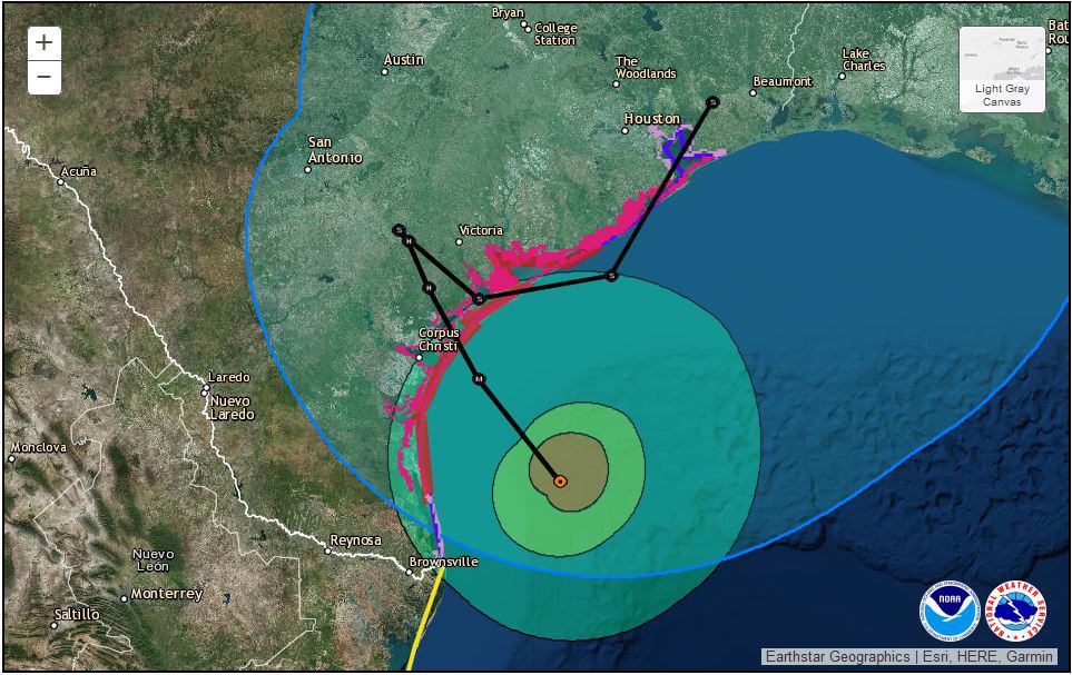
On September 11, another tropical wave in the western Caribbean Sea began to move North across Campeche into the Gulf of Mexico. It became better organized on the 12th and the NHC designated the cyclone as Tropical Storm Nicholas. On September 14, a weather station record 76 MPH sustained winds and the NHC upgraded the system to Hurricane Nicholas. The hurricane made landfall on Sargent Beach, Texas later that day. After moving inland, Nicholas lost strength. Nicholas followed the coast to Louisiana and became post-tropical near Marsh Island. Damages were estimated at 2.2 billion dollars.
On the same day as the tropical wave that would form Nicholas began to organize, disturbed weather over the Bahamas began to form a low-pressure area with well-defined circulation. However, the circulation was displaced by wind shear from the storm center. The system further organized on September 17 into Tropical Storm Odette about 175 miles east of North Caroline-Virginia. Cold, dry air weakened the storm and it transitioned to an extratropical cyclone on September 18.
Top Ten Tips to Survive a Hurricane Disaster
Another system on September 11, the same day as Nicholas and Odette, began toward the Coast of Africa and emerged on the 18th. By September 19, it had enough organization for the NHC to classify it as depression. Six hours later they upgraded the storm to Tropical Storm Peter. 35 MPH wind shear displaced Peter’s center by almost 100 miles and forecasters did not expect the storm to survive the buffeting. It brought heavy rain to the Leeward Islands, Virgin Islands, and Puerto Rico. On September 21, Peter weakened to a depression late in the day and degenerated to a low on September 23. The NHC continued to monitor Peter for further development until September 29.
A tropical wave followed on the heels of Peter approached the coast of Africa on September 15. It formed a low-pressure system but remained disorganized until September 19 when it became a Tropical Depression. Later that day it gained strength and was named Tropical Storm Rose. Rose would succumb to the same wind shear conditions as Peter and became a post-tropical cyclone on September 23.
Yet another wave headed for the coast of Africa on September 19. Storms associated with the wave increased as it moved over the Atlantic. By September 22, it became Tropical Depression Eighteen. The next day it had strengthened into Tropical Storm Sam. Sam intensified to Category 1 on the 23rd before undergoing rapid intensification and reached category 3 on the 25th. Six hours later, Hurricane Sam was category 4 with a very well-defined eye. The next day, Hurricane Sam reached peak intensity at category 4 or 5 with 155 MPH winds.
Home Emergency Evacuation Plan
Sam weakened briefly, then strengthened back to category 4 on September 28. Another second peak was reached on October 1 at 150 MPH. As it headed into the North Atlantic, Sam gradually lost strength until becoming an extratropical cyclone over colder north Atlantic water.
Subtropical Storm Teresa formed out of a surface low east of Bermuda. As it moved Northwest on September 24, it formed a well-defined center with gale-force winds. The NHC named the system Subtropical Storm Teresa. Cool waters inhibited development in conjunction with dry air and wind shear. It lost strength and went post-tropical on the 25th.
Tropical Storm Victor came out another African Tropical Wave. It became Tropical Depression Twenty on September 29 and continued to strengthen. The NHC named it Tropical Storm Victor the same day. Victor reached peak intensity on October 2 with sustained winds of 65 MPH. Wind shear prevented further development and weakened the storm until it became a low-pressure trough on October 4.
Wanda the Last October Storm
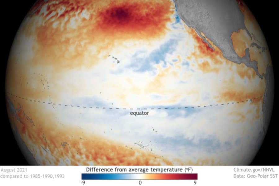
Cooler Sea Surface Temperatures (SSTs) in the Eastern Tropical Pacific Ocean Are a Good Indicator of an Increase in Atlantic Cyclone Activity.
The NHC expected a disturbance off the East Coast would develop into a nor’easter before transitioning to a tropical or subtropical storm. It brought heavy rain, wind, and coastal flooding to the Northeast from October 25 to 27. On the 31st, the Halloween storm developed subtropical characteristics and was named Wanda. It fully transitioned to a tropical storm by November 1. Tropical Storm Wanda then wandered over the Central and Northern Atlantic for a week. Cold water and interactions with a low-pressure system brought an end to the deep convection.
Wanda’s development caused two deaths in the United States and over 200 million in damages.
November and December
No named storms were formed in November. If December produces a subtropical or tropical storm or hurricane, the name will come the supplemental list that replaced the Greek Alphabet names used in the past.

