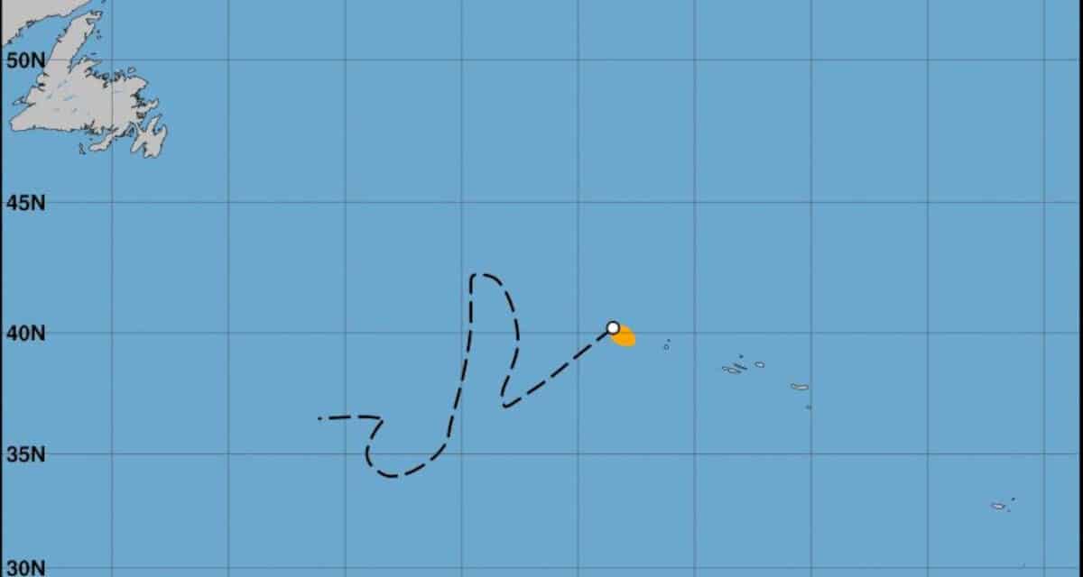
Tropical Storm Wanda followed a meandering, zig-zag path influenced by differing weather systems as it crossed the Atlantic before becomign a post-tropical cyclone late Sunday, November 7 and speeding northeast before dissipating.
NOAA National Hurricane Center Graphic
21st Named Storm Marks 2021 as Third Busiest on Record
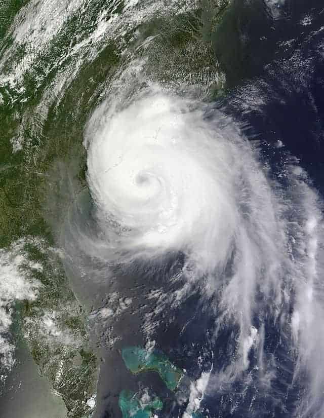
Wanda formed as a large subtropical cyclone over the Atlantic on Saturday, October 30 with sustained winds of up to 50 MPH. Tropical-storm force winds extended up to 105 miles from the center, making Wanda a relatively large cyclone more than 200 miles across. Tracking southeast, some strengthening was possible as it moved over warmer waters.
Tropical Storm Wanda was the 21st named storm of the 2021 Atlantic Hurricane Season. There are three weeks left until the season ends on November 30. If another storm is named before January 1, 2022, the name will come from the new supplemental list of storm names for the Atlantic Basis. The first three names on the supplemental list are Adria, Braylen, and Caridad. Storm names on the regular list and the supplemental list are maintained by the World Meteorological Organization.
2021 Atlantic Hurricane Mid-Season Update
On Monday’s 9:00 PM GMT advisory, the NHC reported that Wanda had transitioned to a tropical storm as it separated from the upper-level low that contributed some of its energy. In the transition to a tropical storm, Wanda became a much smaller cyclone. Separation also took it away from vertical shear associated with the low-pressure system and moved it over warmer water. The forecast for other weather patterns to develop indicated that Wanda might zig zag toward the Azores with some strengthening possible.
By the Wednesday 9:00 PM advisory, Wanda had again increased in size with tropical storm force winds extending 105 miles away from the center. The size would continue to fluctuate and by Thursday evening, had expanded to 250 miles across with little change in strength or intensity.
Best Natural Gas Generators for Hurricane Outages and Blackouts
Wanda transitioned to a post-tropical cyclone Sunday night as it merged with a frontal system northwest of the Azores. Winds decreased to 40 MPH as it accelerated northeastward at 25 MPH. Gale force winds extended outward up to 70 miles from the storm center. The National Hurricane Center issued its last advisory on Wanda at 3:00 PM GMT on Sunday. By midnight, the post-tropical cyclone Wanda had moved well to the north of the Azores and was expected to dissipate by Monday evening.
The tropics aren't dead yet! #Wanda is now a tropical storm in the open waters of the Atlantic. It's the 21st named storm of the season, won't impact land, but it does mean we are living through the 3rd busiest Atlantic hurricane season on record! pic.twitter.com/Wa52aIGEN4
— Wes Hohenstein (@WeatherWes) November 1, 2021
5 pm Tuesday Tropical Storm #Wanda Advisory & Cone. Should stay as an open water system. pic.twitter.com/ekExevIIGH
— Phil Ferro (@PhilFerro7) November 2, 2021

New Storm Possible with 3 Weeks Left to the 2021 Hurricane Season

With 21 named storms in the books, the Above Average 2021 Atlantic Hurricane Season has three weeks left. However, tropical cyclones can form at any time of year including late December and early January. Tropical Cyclones have formed in every month of the year.
7 Hurricane Preparedness Checklists for the 2022 Hurricane Season
A new system formed about 400 miles east of Cape Hatteras with storm-force winds and is moving east-northeast. Like Wanda, it could separate from the associated frontal system and become a tropical or sub-tropical storm. However, it will likely merge with a larger low-pressure system over the north-central Atlantic. Forecasters see a decreasing chance of formation over the next five days. If this system does become a tropical or sub-tropical cyclone, it will be named Adria from the new supplemental list of named storms provided by the WMO. The supplemental list contains 21 names.
New Generac 26kW Generator

The New Generac 26kW Generator is the largest, most powerful and efficient home standby generator on the market. Norwall is now taking pre orders.


