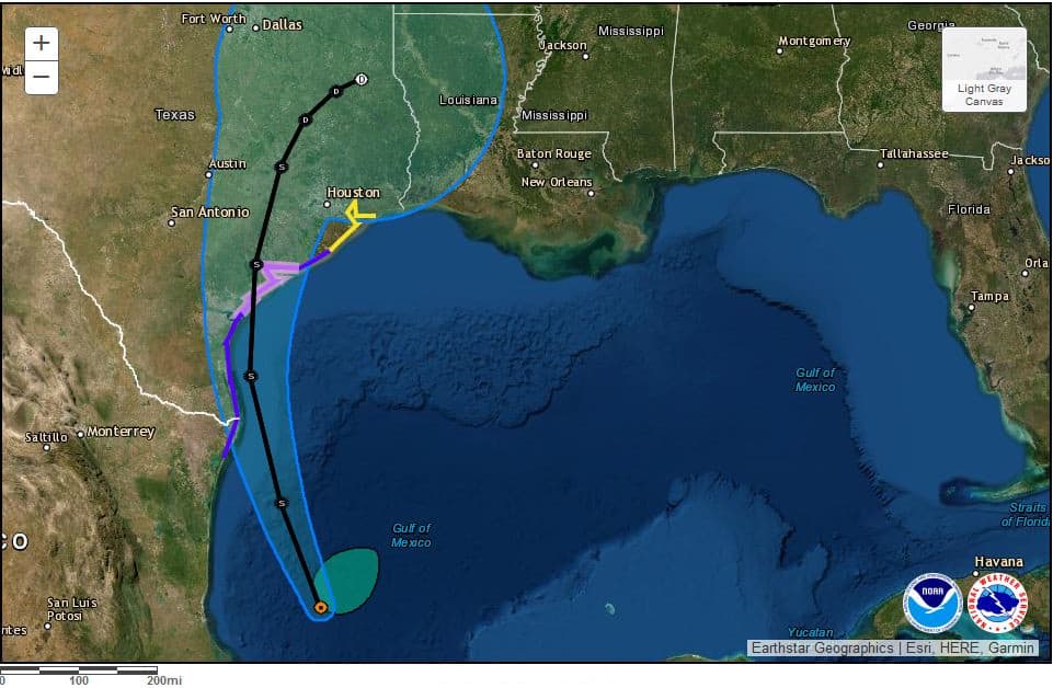
National Hurricane Center Forecast with Wind Watches, Warnings, Storm Surge Watches and Warnings on September 12, 2021.
National Hurricane Center Graphic.
14th Storm of the Atlantic Hurricane Season to Bring Heavy Rain–Flooding–Storm Surge
Tropical Storm Nicholas formed over the Bay of Campeche out of a tropical wave that crossed the Yucatan Peninsula from the eastern Caribbean Sea. Nicholas has 40 MPH sustained winds and is moving north over the very warm surface sea temperatures of the southwestern Gulf of Mexico. The current forecast for Nicholas includes landfall as a strong tropical storm on the Texas coast sometime on Tuesday, September 14th.
Nicholas is still in the formation stage. According the to the National Hurricane Center in Miami, Florida, if the storm’s track moves east, it will spend more time over the warm Gulf water and gain more strength, possibly becoming a hurricane before landfall.
Pick the Best Portable Generator for Home Backup
Watches and Warnings
Hurricane Watch is in effect from Port Aransas to Sargent.
Tropical Storm Warning is in effect from the Mexico Border to Port Aransas and from Sargent to High Island. A tropical storm warning is also in effect for Mexico from the border south to Laguna Madre.
A Storm Surge Warning is in effect from Port Arthur to the Galveston-Brazoria County Line. Storm Surge Watch is in Effect from the Mexico Border to Port Arthur and from the Galveston-Brazoria County Line to High Island.
Tropical Storm Nicholas could leave heavy rain, wind & possible flooding in various regions along the Gulf Coast.
— Greg Abbott (@GregAbbott_TX) September 13, 2021
The state began mobilizing resources on Saturday to support local officials.
Heed warnings from local officials and be sure to avoid high water.
Stay safe, Texas. pic.twitter.com/YhsduKBWjq

Satellite Image taken at night showing the clouds (in yellow, red, and dark red) associated with Tropical Storm Nicholas.
NOAA Satellite Image Taken 8:40 PM Sunday, September 12, 2021
Tropical Storm Nicholas Key Messages from the National Hurricane Center
- Expect periods of heavy rain with significant rainfall along the Texas and Louisiana Coasts through the middle of the week. Considerable flash flooding and urban flooding are possible, especially in metropolitan areas. Minor river flooding is also possible.
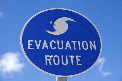
- Dangerous and life-threatening storm surge inundation is possible within the warning and watch areas. Residents should follow advice given by local officials, including evacuation.
- The forecast calls for Tropical Storm Nicholas to grow in intensity as it crosses the warm Gulf waters. If the storm track moves to the east, the cyclone could reach hurricane strength before landfall. A hurricane watch is in effect for portions of the coast. Hurricane conditions are possible in the watch area from Port Aransas to Sargent late Monday and Monday night.
- Tropical storm conditions expected along the northeast coast of Mexico and Texas south coast beginning Monday Morning.

The shaded white around around the storm track is not the size of the storm, but the probable/possible storm track. The cone on this graphic indicates a possible landfall anywhere from south of the Texas-Mexico border to southwest Louisiana.
National Hurricane Center Graphic.
Forecast Uncertainty
Nicholas is over very warm water in the Gulf of Mexico. Under ideal conditions, the ocean heat would fuel the storm and help it strengthen rapidly. However, Tropical Storm Nicholas is moving through an area of south-southwesterly wind shear from the upper-level trough over northern Mexico. As the trough moves west and weakens over the next day, Nicholas will gain strength. How much and how fast depends on how quickly the trough moves west and whether the cyclone track moves east or west.
Some computer models point to a landfall near the Texas-Mexico border, others give the storm more time over water and further strengthening, including the possibility of a hurricane. As the storm continues its development, the final track and strength become more certain.
Follow reports by local forecasters and advice by local officials. Heed warnings and be aware of the potential for significant urban flooding and flash flooding.
Hurricane Preparedness
- Hurricane Hazards and Risk Factors
- Make a Hurricane Evacuation Plan
- Hurricane Preparedness Kits and Supplies
- Hurricane Insurance Checkup and Updates
- Prepare Your Home for Hurricanes
- Help Neighbors with Hurricane Preparedness
- Complete Your Hurricane Preparedness Plan
- Emergency Preparedness Tips
- How to Prepare for a Power Outage
- 10 Tips to Survive a Hurricane Disaster
- FEMA Recommends a Generator
- Hurricane Disaster Preparedness


