Major Hurricane Helene to Bring Storm 20-Foot Storm Surge
Update: September 25, 2024 6:00 PM EDT
Mandatory and Voluntary Evacuation Orders are in effect. If you are in an evacuation zone, fill your vehicle with fuel, complete your prepararations, take your emergency supplies and kits, and leave via an evacuation route as soon as possible.
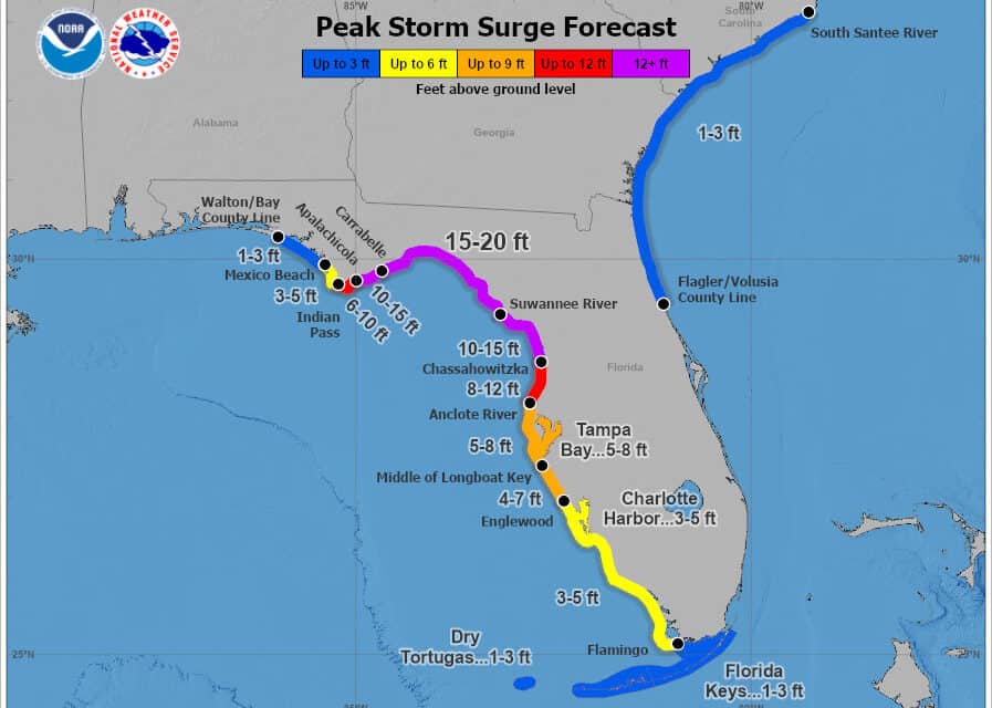
Hurricane Helene will be a strong Catagory 3 or Category 4 Hurricane when it makes landfall on the Florida Big Bend Region with a 20-foot storm surge, flash and urban flooding, and river flooding. Catastrophic winds up to 160 MPH expected.
Key Messages from the National Hurricane Center.
- Hurricane Helene is rapidly intensifying over the Gulf of Mexico. Forecasters expect a strong Category 3 or 4 storm by 1:00 PM CDT on Thursday.
- Catastrophic and Life Threatening Storm Surge could exceed 20-feet with dangerous and damaging waves from Apalachicola east and south to the Chassahowitzka. 10-15 Feet and 8-12-feet in adjacent areas. Storm Surge is fast-moving, rapidly rising water capable of removing buildings from foundations and is responsible for 50% of all hurricane fatalities.
- Storm surge is expected along most of the Florida Gulf Coast.
- Complete Preparations by Thursday Morning—Tropical Storm Conditions begin arriving after 8 AM.
- Expect catastrophic hurricane force winds when Helene makes landfall in the Florida Big Bend region late Thursday. Hurricane Force Winds will reach into south Georgia on Thursday into Friday, strong winds into northern Georgia and the Carolinas.
- Life Threatening Catastrophic Flash flooding with landslides will occur across portions of the southern Appalachians through Friday. Widespread minor to moderate river flooding is likely with major river flooding possible.
9/25 5pm EDT: There is a danger of life-threatening storm surge from #Helene along the west coast of the Florida Peninsula & Florida Big Bend, where a Storm Surge Warning is in effect.
— NHC Storm Surge (@NHC_Surge) September 25, 2024
Residents in the warning area should follow advice & evacuation orders from local officials. pic.twitter.com/zwhQLZapUr
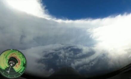
Hurricane #Helene’s circulation is really coming together now.
— Zoom Earth (@zoom_earth) September 25, 2024
Latest satellite view 🛰️ pic.twitter.com/GKLeVXiIRE
Potential Tropical Cyclone 9 Becomes Tropical Storm Helene
Thursday, September 24, 2024. 1:30 PM EDT.
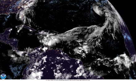
Forecasters upgraded Potential Tropical Cyclone 9 to Tropical Storm Helene this morning in the 11 AM EDT advisory. Helene is currently 200 miles west of George Town with sustained winds of 45 MPH moving northwest. It will pass just east of Cancun Wednesday morning while turning to the north.
Tropical Storm Warnings and a Hurricane Watch are in effect for western Cuba and Eastern Mexico, Including Cancun.
Helene will continue to strengthen as it crosses the Gulf of Mexico, gradually turning to the north by northeast and become a major hurricane by Thursday morning.
Storm Surge, Tropical Storm Watches, and Hurricane Watches are in effect for most of the western Florida peninsula through the Big Bend region to Alys Beach. The watches will upgrade to Hurricane Warnings and Storm Surge Warnings within the next 24 hours.
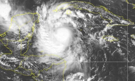
On its current track, forecasters expect landfall as a category 3 major hurricane near Live Oak Island and Wakulla Beach south of Tallahassee, Florida on Thursday evening with storm surge, coastal and inland flooding, flash floods, tornadoes, and winds over 115 MPH.
Florida Residents should hurry to prepare. Tropical Storm conditions will arrive in the Florida Keys beginning Wednesday morning. Southern Florida by Wednesday Evening, and the Panhandle and Big Bend region by Thursday Morning.
The forecast storm surge with #Helene is something to be taken very seriously, and mandatory evacuations are already in effect for many Florida counties. Follow the guidance from local authorities. It is literally a matter of life and death.
— National Weather Service (@NWS) September 24, 2024
You can see more about evacuations in… pic.twitter.com/bGI2OfQuKm

Tropical Storm Helene National Hurricane Center Key Messages
Helene will intensify and be near hurricane strength as it reaches the far northwestern Caribbean Sea. Expect tropical storm conditions over western Cuba and the northeast coast of the Yucatan Peninsula. Hurricane conditions are possible.
Helene will intensify rapidly over the Gulf of Mexico and be a Major Hurricane as it approaches the Florida Coast on Thursday.
Florida impacts include life-threatening storm surge and damaging hurricane-force winds along the Florida Panhandle and the Florida west coast. Hurricane and Storm surge watches are in effect for most of the Florida coast.
Residents in the watch areas should follow the advice of local officials, stay updated with local weather reports and the National Hurricane Center.
Heavy rain will cause considerable flooding and mudslides across western Cuba.
Heavy rain across Florida will result in flash and urban flooding across the Southeast, Southern Appalachians, and the Tennessee Valley from Wednesday Through Friday. Minor to isolated river flooding is also possible.
Follow the National Hurricane Center, Local News and Weather, and Local Government on Social Media.
Hurricane Preparedness
- Hurricane Hazards and Risk Factors
- Make a Hurricane Evacuation Plan
- Hurricane Preparedness Kits and Supplies
- Hurricane Insurance Checkup and Updates
- Prepare Your Home for Hurricanes
- Help Neighbors with Hurricane Preparedness
- Complete Your Hurricane Preparedness Plan
- Emergency Preparedness Tips
- How to Prepare for a Power Outage
- 10 Tips to Survive a Hurricane Disaster
- FEMA Recommends a Generator
- Hurricane Disaster Preparedness

11 am EDT - Tropical Storm #Helene forms. Hurricane and Storm Surge Watches in effect for portions of Florida. Here are the Key Messages. https://t.co/tW4KeGdBFb pic.twitter.com/O2vrmnsReN
— National Hurricane Center (@NHC_Atlantic) September 24, 2024
There's a big difference; don't focus on the center. Focus on the impacts. #Helene pic.twitter.com/rxh2NU7ULw
— Brad Panovich (@wxbrad) September 24, 2024
Discounted Portable #Generators at Norwall.
— Norwall PowerSystems (@NorwallPowerSys) September 13, 2024
Save 💲💲💲 on these models while supplies last.
🔷Scratch & Dent Inverters
🔷Clearance Generators
🔷Full Manufacturer Warranty
🛒https://t.co/NxREUACGiX Todayhttps://t.co/5JNAXGWUTY#generator #Discounts pic.twitter.com/7Qia4OL7t0


