Unusual Fourth Named June Storm Forms in North Atlantic
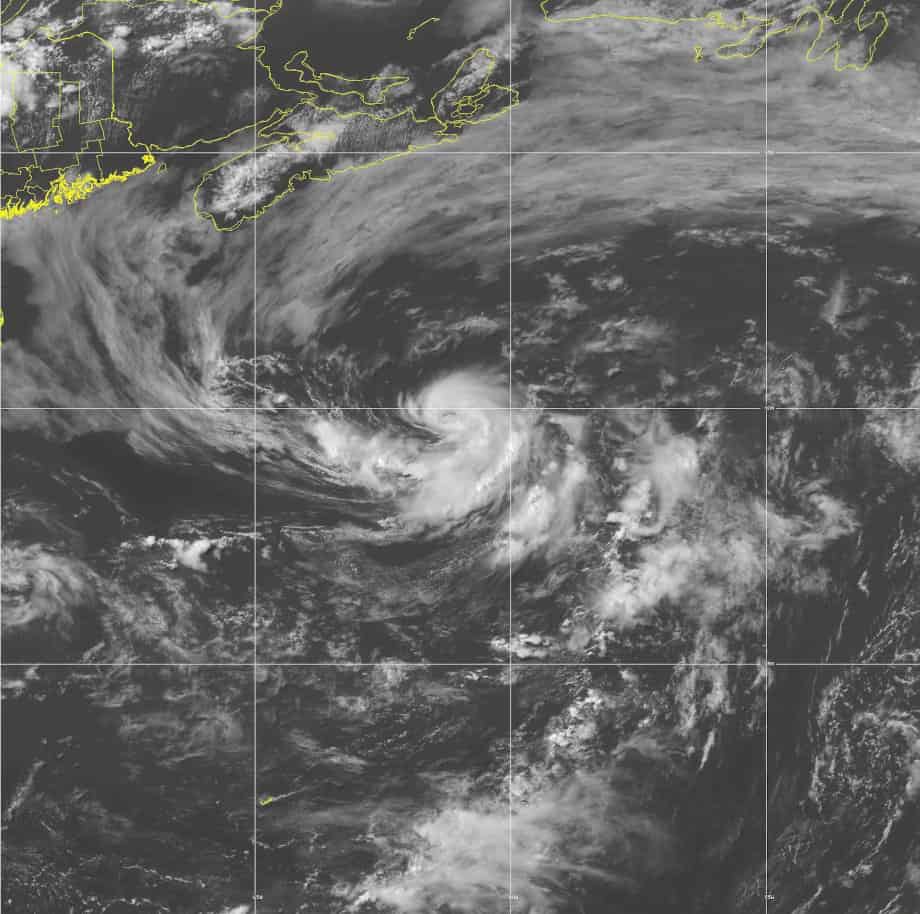
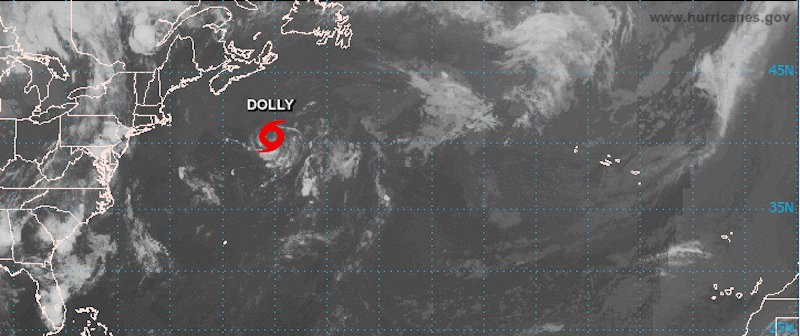
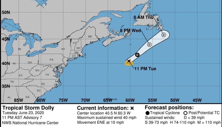
June 23, 2020: Tropical Depression 4 strengthened into Tropical Storm Dolly this morning with 45 MPH winds about 370 miles south of Nova Scotia, Canada. Four named storms in the month of June is an unusual occurrence. Subtropical depression 4 stayed over the warm Gulf Stream long enough to organize into a tropical storm. The current movement is 13 MPH east northeast. Dolly should weaken on Wednesday and through Wednesday night as it passes Newfoundland until it dissipates on Thursday.
Standby Generators—The Best Defense Against Power Outages
On Monday, the subtropical depression had little chance of further organization. All Global and regional forecast models indicated a faster forward speed this evening through Thursday, passing over cold North Atlantic waters. The NHC discussion expected a large extratropical low to absorb the storm unless it dissipated. A 10 percent chance of further organization evolved into a tropical storm this afternoon.
Dolly is the second earliest D-named Atlantic Storm and only the third in history to form in the month of June. The other two storms were Danielle in 2016 and Debbie in 2012. Debbie and Danielle formed over the Gulf of Mexico, a much warmer body of water than the north Atlantic.
2020 Atlantic Hurricane Season Forecast
Active Hurricane Season Likely
This year’s hurricane season forecast has grown since the first discussion in December. By April, forecasters were looking at an above average season. Shortly after the June 1 start of the season, most tropical forecasts for the Atlantic Ocean, Caribbean Sea, and Gulf of Mexico predicted up to 19 named storms.
Arthur and Bertha formed in May, prior to the season start. Arthur skirted past North Carolina and the Outer Banks with torrential rain and heavy seas before it turned east. Bertha made landfall in South Carolina with 50 MPH winds after drenching Florida.
FEMA Recommends a Backup Generator
Cristobol turned into another unusual storm after it made landfall in Louisiana and headed north. It brought an unusually high storm surge for a tropical storm, heavy rain, and near hurricane force winds. Instead of dissipating, Cristobol remained a tropical depression as it headed into the Midwest through Arkansas, Missouri, Illinois, Iowa, Minnesota, Wisconsin, and Upper Michigan. Wisconsin saw tropical storm force winds. The storm finally weakened to a post-tropical depression over the Great Lakes.
Dolly poses no real threat to land. Nova Scotia will experience some heavy surf conditions. Newfoundland can expect gusty winds and rain.
Hurricane Preparedness: Risks and Plans
Dust Cloud Over Eastern Atlantic and Caribbean

For the next week or so, a cloud of dust with origins in the Sahara Desert will keep the tropical environment over the Atlantic Ocean and Caribbean Sea dry and dusty. Lack of atmospheric moisture combined with high pressure will inhibit formation of any tropical cyclones.
Dolly is a reminder that coastal residents should prepare. An average hurricane season has 12 named storms. 2020 could have up to 19 if the current forecast holds, including up to 10 hurricanes and as many as six major hurricanes. Four weeks remain before the season begins to peak in late July.
Are You Ready?

