Earliest E-Named Storm in History for North Atlantic Ocean
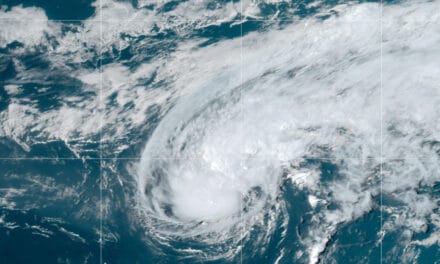
Tropical Storm Edouard formed on July 6th and became the earliest named storm to begin with the letter E, the fifth named storm of 2020. The NOAA names storms in alphabetical order. Earliest this season, Tropical Storm Dolly was the second earliest “D-named” storm when it formed in June. Edouard, which poses no risk to North America, should transition to a post-tropical cyclone in the next few hours as it moves over colder water.
The 2020 Hurricane Season could become one of the most active seasons on record with up to 20 named storms. Hurricane forecasters name cyclones when they strengthen from a tropical depression to a tropical storm. Depressions have maximum sustained winds of 38 miles per hour. Tropical storm winds reach 73 MPH and hurricanes from 74 MPH and higher. Though high winds an hurricane category numbers make headlines, Tropical storms carry exceptionally heavy rain—sometimes measure in feet—and cause widespread flooding.
How to Plan and Prepare for Hurricane Season

Atlantic Basin Active as Dust Storm Dissipates
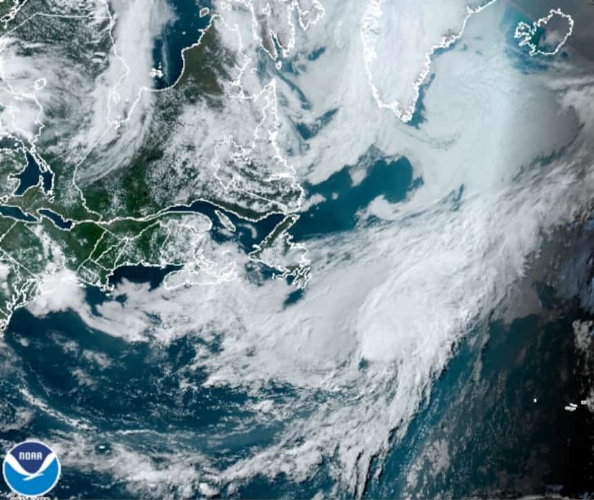
The Saharan Dust Cloud that combined with an area of wind shear over the Atlantic Ocean to inhibit tropical activity has moved on. Dry air, dust from Sahara Desert storms, and strong winds that opposed cyclone formation kept the Atlantic quiet for more than 10 days. As the dust cloud moved on, forecasters noted areas of possible development over the holiday weekend.
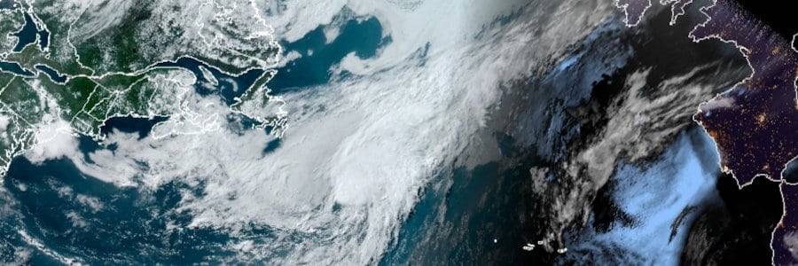
Tropical Depression 5 became Tropical Storm Edouard late on July 5. The National Hurricane Center and other weather forecasting agencies are watching two additional areas of interest with at least some potential to organize into cyclones. One system has already moved over Florida from the Gulf of Mexico and will emerge over the Atlantic sometime Wednesday. A moderate possibility exists for this system to organize into a tropical depression or storm.
A tropical wave east of the Windward islands is another system to watch for the next few days. Currently, the NHC gives the tropical wave a small chance of organization for the next few hours. Once it moves into the Caribbean, dryer air and wind shear should prevent further development.
The Best Natural Gas Generators for Hurricane Power Outages

Hurricane Season Begins to Peak in July
The Atlantic Hurricane Season starts June 1 and runs through November 30. Hurricanes and other tropical cyclones can form at any time of year, like the two storms that formed in May before the 2020 season began. In late July, the season activity begins a climb toward the peak in September with a decline from late October through November.
10 Tips to Survive a Hurricane Disaster
Over the next few weeks, warm ocean temperatures and seasonal climatic changes promote tropical cyclone development with weather patterns that favor the Caribbean and Gulf of Mexico instead of the North Atlantic Ocean. The next three to four months pose the most danger to Caribbean, Gulf of Mexico, and United States Coastal areas.
This year, forecasters give a better than even chance that at least one Major Hurricane could hit the United States Coast before the season begins to decline in later October and November.


