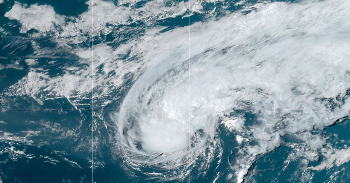
Tropical Storm Gaston over the Subtropical Central Atlantic with 65 MPH winds. Gaston includes non-tropical characteristics which makes it a hybrid storm. NOAA Satellite Image September 22, 2022
Atlantic Basin Becomes Active After Quiet Summer
The Sub-Tropical Atlantic Low Pressure Area mentioned in the September 19 post on Major Hurricane Fiona became Tropical Depression Eight at 1500 UTC on Tuesday. Although no watches or warnings were issued, the National Hurricane Center in Florida stated that interests in the Azores should monitor the storm’s progress. By 2100 UTC, further organization and intensity prompted the NHC to name the cyclone Tropical Storm Gaston.
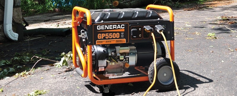
Power Outage! Benefits of Household Generators
Tropical Storm Gaston further intensified with 65 MPH winds as it heads generally east-northeast toward an area just north of the Azores. It will briefly turn south while it undergoes a transition to an extratropical cyclone, then turn back toward the northwest.
The NHC mentions in its discussion today that Gaston is not purely tropical and is probably a hybrid system gaining energy from local atmospheric conditions.
Gaston will gain strength over the next 12 hours and could near hurricane strength before gradually weakening over the next few days in a region of dryer air and increasing wind shear.
Is Your Family Ready for the Next Power Outage?
Wide variances in computer models could bring the storm closer to the Azores before it executes a U-turn and picks up forward speed away from the islands. The strong tropical-force winds will bring high seas and heavy surf to the Azores. Residents and other interests should continue to monitor Gaston for changes in the forecast.
Category 3 #Hurricane Fiona left catastrophic #Floods in Puerto Rico. Life-Threatening #flooding continues in Turks-Caicos. Bermuda and Canada Next https://t.co/hxvinz3FNE pic.twitter.com/cODT6u5NtC
— Norwall PowerSystems (@NorwallPowerSys) September 20, 2022
#Gaston has formed in the North Atlantic, about 1000 miles west of the Azores. Gaston is the 7th Atlantic named storm of the 2022 Atlantic #hurricane season. On average, the 7th Atlantic named storm forms on September 3rd. pic.twitter.com/KdAFzvJ60y
— Philip Klotzbach (@philklotzbach) September 20, 2022

Did you know that a standby generator can start and run in any weather, including a hurricane? Fully automatic, they run on propane or natural gas for days or weeks until the utility restores power.
Hurricane #Fiona Advisory 28A: Tropical Storm Warning and Hurricane Watch Issued For Bermuda. https://t.co/tW4KeGe9uJ
— National Hurricane Center (@NHC_Atlantic) September 21, 2022
5 Active Systems the Atlantic

After a relatively quiet summer and an unimpressive hurricane season peak, the tropical Atlantic turned active.
NOAA National Hurricane Center Graphic September 21, 2022.
With Tropical Storm Gaston, there are a total of five tropical systems to monitor over the Atlantic, up from three just two days ago.
Hurricane Fiona
Hurricane Fiona has intensified to a category 4 storm, the first of the season. It may weaken to a category 3 major hurricane sometimes tomorrow. Tropical Storm Warnings and a Hurricane Watch are in effect for Bermuda. Fiona could make landfall on Nova Scotia on Saturday and Newfoundland and Labrador on Sunday as strong hurricane-strength extratropical cyclone. Atlantic Canada should closely monitor the storm.
Portable Generator Safety Rules to Live By
Western Tropical Atlantic
The tropical wave mentioned in the September 19 post is nearing the Windward Islands. It presently has a 90 percent chance of forming a tropical depression within a day or two as it enters the Caribbean Sea. Residents and other interests in the islands, Venezuela, Columbia, and the ABC island chain should expect heavy rainfall later this week. This could be the next system to move into the Gulf or Central America
Tropical East Central Atlantic
Another Tropical Wave west of the Cabo Verde Islands shows increasing signs of activity. The dry environment slows the development of this system, but additional organization is possible over the next five days as it moves west and later this week, northwest. Current chance of development is 30 percent over the next five days.
How to Use a Portable Generator for Backup Power
Tropical East Atlantic
Another tropical wave will move off the coast of Africa on Thursday into conditions conducive for development. This system has a better chance of development than the East Central tropical wave mentioned above. Forecasters give this system a moderate chance of becoming a tropical depression over the weekend as it moves north and northwest between the coast and the Cabo Verde islands. The current chance of development is 50 percent over the next five days.
#Fiona is now a Category 4 #hurricane with maximum sustained winds of 130 mph - the first Category 4+ hurricane of the 2022 Atlantic hurricane season. Since 2000, three Atlantic seasons have had 0 Category 4+ hurricanes: 2006, 2012, 2013. pic.twitter.com/vC4HOxIv7S
— Philip Klotzbach (@philklotzbach) September 21, 2022
In addition to #Fiona and #Gaston, the National Hurricane Center is monitoring three additional areas with a 90%, 50% and 30% chance, respectively of tropical cyclone formation in the next 5 days. After a slow start, the Atlantic hurricane season has ratcheted up quickly. pic.twitter.com/aMk3uBI8qy
— Philip Klotzbach (@philklotzbach) September 21, 2022


