Cristobal to Reach U.S. Coast by Late Sunday–Early Monday
Update Friday June 5, 11:45 AM CDT: The National Hurricane Center has issued a Tropical Storm Watch from Louisiana to the Florida state line, and a Storm Surge Watch from Louisiana through the entire east coast of Florida.
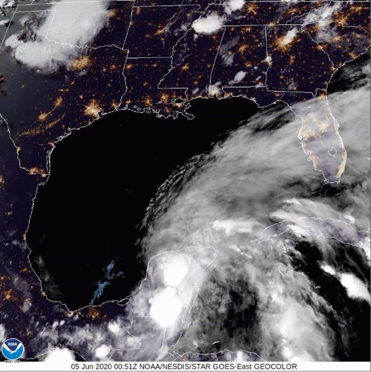
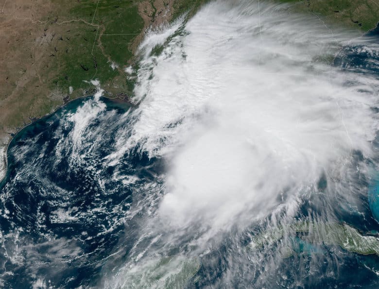
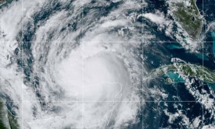
June 5, 2020: Tropical Storm Cristobal drifted south over Mexico where it stalled and weakened to a tropical depression. The storm is making a turn toward the east and then north. Once over the warm Gulf of Mexico, Cristobal will regain strength on its way to the U.S. Gulf Coast. Current tracking indicates a landfall anywhere from East Texas to the Mississippi.
Automatic Standby Generators–Best Defense Against Outages
Up to 14 inches of rain fell over some parts of Mexico with life-threatening flooding and mudslides. Heavy rain affected Belize and Guatemala. Already a large, wide storm, the cyclone will strengthen and expand as it travels north over the Gulf with gusts up to 70 MPH and 60 MPH sustained winds. Cristobal may bring storm surge and flooding from the Louisiana landfall east through Florida along with the heavy rain, dangerous surf, and the possibility of rip currents.
Storm Surge and Inland Flooding cause more deaths and damage more property than all other tropical cyclone factors combined.
National Hurricane Center Forecast Track put landfall in mid Louisiana. Some change in course could take place before the storm reaches land. After it moves over land and loses strength, Cristobal may travel through the Central U.S. until it reaches Lake Michigan.
The Best Natural Gas and Propane Generators for Hurricane Preparedness
Inland Hurricane Hits Pennsylvania, New Jersey
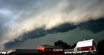
Straight-Line Winds Often Reach Hurricane Strength
Fast moving storms brought wind gusts up to 90 MPH to New Jersey and Pennsylvania on Wednesday. Four people died and more than 500,000 were left without power Wednesday Night. Widespread outages continued through Thursday.
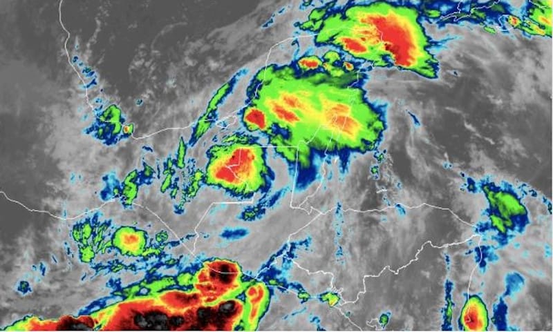
Tuesday thunderstorms across the northern Plains, Upper Midwest, and Great Lakes regions shifted east on Wednesday. The fast-moving storms traveled at up to 80 MPH, a rare weather occurrence.
The weather event, called a Derecho, is a widespread windstorm with straight-line winds that can reach hurricane strength. Derechos spawn tornadoes, bring heavy rains, and may cause flash flooding. The storm’s clouds often form c-shape or bow shaped shelf clouds.
Top Five Portable Generators for Emergency Power
On Wednesday, two people were killed when a tree fell on a country club. Two others died in separate incidents when trees fell on their cars.
The North Central Region has an average Derecho event once per year, with 25 percent more across northeast Oklahoma, northwest Arkansas, and southeast Missouri. Pennsylvania has a Derecho about once every two years, New Jersey every four.
Hurricane Preparedness: Make a Plan
Tropical Storm Cristobal
Cristobal should serve as a reminder that forecasters expect an above average hurricane season. Anyone living in a coastal state, especially those living along the coast, should prepare before a hurricane forms and tracks toward the United States. The 2020 Atlantic Hurricane Season has the potential for up to 19 named storms (three so far.) Two formed before the season started.
How to Prepare for a Power Outage
The Colorado State University Tropical Meteorology Project released it’s Forecast for 2020 Hurricane Activity today (June 4.) The forecast previously called for an above average season with up to 16 named storms. CSU as increased the forecast to include 9 hurricanes and 4 major hurricanes.
Neutral El Niño conditions in the Pacifica may trend toward a weak La Niña, which will contribute to increased activity in the Atlantic Basin. Coupled with high than normal water temperatures, CSU forecaster expect more tropical cyclone activity.
FEMA Recommends a Backup Power Source for ALL Families
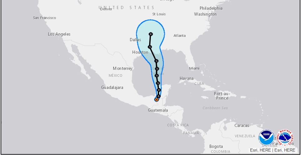
The Blue Cone Represents possible variations in the storm path. It is NOT the storm’s size, which may be much larger than shown.


