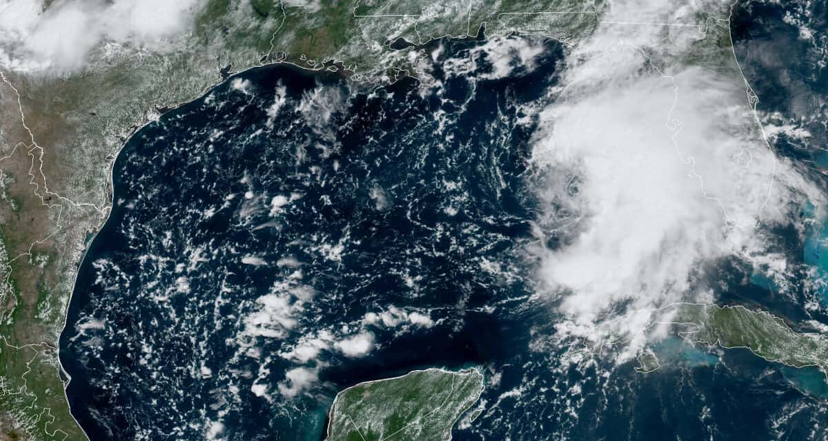
Tropical Storm Fred over the Gulf of Mexico on August 15, 2021. NOAA GOES Satellite Image
Storm Surge and Heavy Rain Expected to Cause Flooding
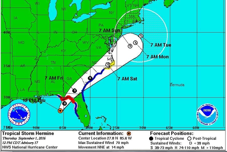
Florida, Sunday August 15, 2021: Tropical Storm Fred will reach the Florida Panhandle on Monday, August 15, 2021. The National Hurricane Center has issued Tropical Storm Warnings for the eastern portion of the panhandle, and Tropical Storm Watches for the western portion. Storm Surge Warnings ranging from a 1 to 4-foot surge are in effect for much of the area. Heavy rain will inundate the area with the possibility for flash floods and local waterway flooding.
The possibility exists for Fred to further strengthen to a hurricane before reaching land. Florida panhandle residents should review their hurricane preparedness checklist and follow the instructions of local authorities. Fred will impact low-lying areas of the Florida Panhandle.
Panhandle residents have less than a day to complete final preparations. Conditions will begin deteriorating later tonight as the storm moves closer. Fred is currently moving north northwest at 12 MPH with a gradual turn to the north expected today and tonight. The storm center should move over land near Fort Walton Beach between 7:00 PM and 8:00 PM tomorrow (Monday, August 16th) with 50 MPH winds, storm surge, heavy rain, and flooding. Power Outages plus the possibility of tornados add the hazards.
Home Backup Portable Generators
Tropical Storm Fred struggled through the Caribbean after beginning as a Potential Tropical Cyclone with tropical storm winds, but without the closed circulation of a Tropical Storm. After crossing the Antilles to Puerto Rico, it organized into a cyclone and was named Tropical Storm Fred. Wind shear and interaction with land would prevent much development. While passing directly over the Dominican Republic and Haiti, it weakened to a tropical depression. Interaction with mountainous Cuba and continuing wind shear further weakened the storm to a remnant low until it emerged over the Gulf and began to strengthen and organize again.
FEMA Recommends Backup Power Source
The NHC reported at 5 AM EDT that Fred had tropical storm force winds greater than 39 MPH. Eight hours later, it had reorganized into a tropical storm. The primary wind field lies to the northeast of the storm center. As Fred approaches land, impacts will reach northeast of the storm first.
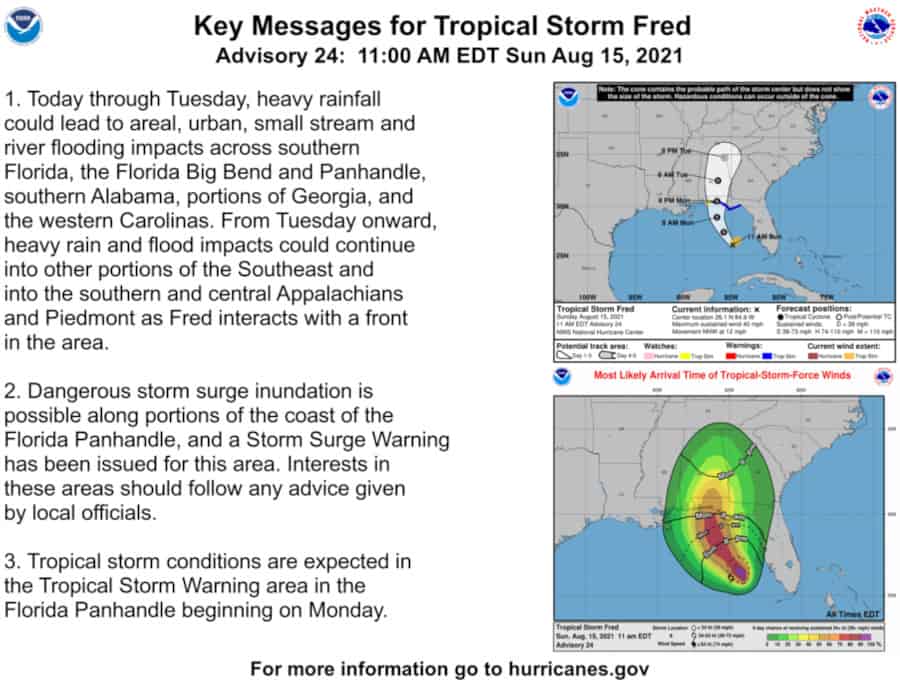
Key Messages for Tropical Storm Fred
Through Tuesday, heavy rainfall could lead to area, urban, small stream, and river flooding across southern Florida, the Florida Big Bend, and the Panhandle. As Fred moves inland, rain and flooding will spread to Southern Alabama, Georgia, and Carolinas. After Tuesday, impacts will spread across the Southeast, Southern and Central Appalachians, and Piedmont.
Hurricane Preparedness: Your Risks
Storm Surge Inundation is possible along portions of the Florida Panhandle Coast and a Storm Surge Warning has been issued. Follow advice by local officials.
Tropical Storm Conditions arrive in the Florida Panhandle beginning Monday.
Did You Know
Storm Surge and Flooding cause more deaths and damage than all other hazards combined?
Stay out of flood waters. Don’t drive through moving water. Don’t try to walk through moving water.
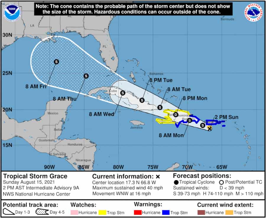
Next Up—Tropical Storm Grace Over the Atlantic
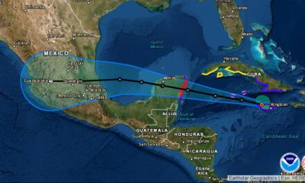
Tropical Storm Grace is just east of the Lessor Antilles on a path that closely follows Tropical Storm Fred. Like Fred, Grace will probably weaken to a depression over the Dominican Republic and Haiti but should regain strength quickly after it emerges over the warm Caribbean Sea. Grace skirt the northern coast of Cuba where interaction with the mountains will limit development.
Natural Gas and Propane Standby Generators for Power Outages
As Grace enters the Gulf of Mexico near the Straits of Florida, further strengthening is possible. The 120-Hour Forecast (August 20) calls for 65 MPH winds over the central Gulf of Mexico. If Grace has good conditions for development, it could easily become a hurricane before it reaches the coast of Louisiana or Texas.
Everyone along the Gulf Coast should monitor Grace over the next five to seven days and begin early preparations for a potential hurricane.

