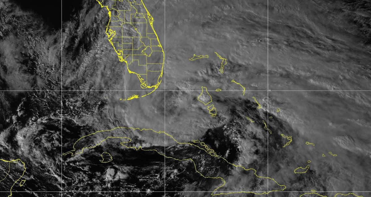
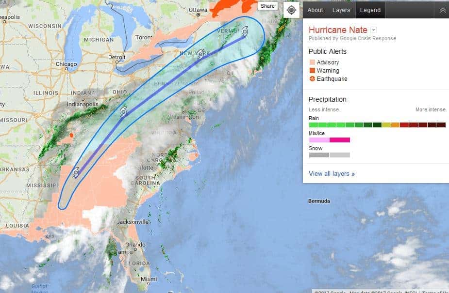
GOES 16 Satellite Image on November 9, 2020 of Tropical Storm Eta bearing down on the Florida Keys. Eta will make landfall as a Tropical Storm, but Hurricane Force Wind and Storm Surge will Follow. NOAA Image.
NHC Issues Hurricane Warning for Florida Keys—Watches for Florida Peninsula
After battering the countries of Honduras and Nicaragua with category 150 MPH wind and 185 MPH gusts, mudslides, and torrential rain for days, Hurricane Eta turned north and left Central America as a tropical depression. Coastal residents of the two Central America countries will go without electrical power for months as they slowly rebuild their homes and power grids.
After crossing the northwest Caribbean Sea and Cuba, Eta reached the Florida Straights as a Tropical Storm and has moved slowly toward the keys. Tropical storm conditions are present and will increase through the night as Eta moves west over warm water. The strongest winds are to the north, east, and southeast of the storm center.
Hurricane Eta will affect Cuba, the Florida Keys, and Florida for the next five or six days with hurricane and tropical storm force winds, heavy rain, storm surge, flooding, and power outages.
How to Prepare for a Power Outage
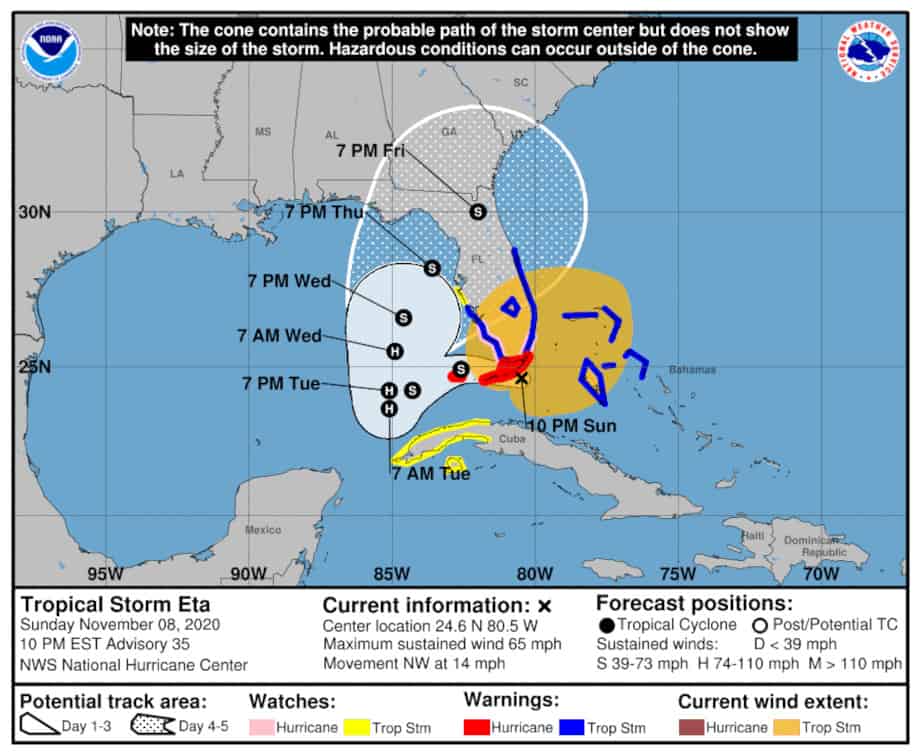
The storm should intensify into a hurricane as Eta moves past the Keys over the warm Gulf of Mexico water with 75 MPH winds and 90 MPH gusts. Hurricane and Tropical Storm conditions will persist throughout the day on Monday.
A Storm Surge warning was also issued for the Florida Keys and portions of the Florida Peninsula. A surge of 1-3 feet is expected for most areas but could reach up to 6 feet along some portions of the peninsula and panhandle. Eta could also spawn a few tornadoes. Power outages are expected with any hurricane.
After crossing the Florida Keys, Eta will jog northeast after returning to hurricane strength on Monday, Tuesday, and Wednesday. The hurricane’s path after Wednesday is uncertain, but the cyclone should begin to weaken. Another landfall is expected on the Florida Peninsula or Florida Panhandle as a tropical storm somewhere between Naples and Panama City.
This is #Honduras after #HurricaneEta. pic.twitter.com/zXerOeWhbv
— Ashley Morales C. (@ashmoralesc) November 6, 2020
Hundreds of people in areas of La Lima & parts of San Pedro Sula in northern #Honduras have been forced onto their rooftops to escape the rising waters & flooding. Many are waiting for boats & rescue teams.
— Honduras Solidarity (@hondurassol) November 5, 2020
This video is circulating on social networks #Eta #HurricaneEta pic.twitter.com/Oa1xKLwZeO
Eta Another Record Breaker in a Record Hurricane Season
Hurricane Eta is the 28th named storm of the record-breaking 2020 Atlantic Hurricane Season. Since Tropical Storm Cristobal set records for the earliest third named storm and broke more record by retaining tropical characteristic is it traversed the Midwest across Wisconsin, Michigan, and Lake Superior, every named storm has set a new record as the earliest on record.
Three systems reached tropical storm strength on September 18 and were named Wilfred, Alpha, and Beta. Alpha was a subtropical storm that formed off the coast of Portugal in the northeast Atlantic. It dissipated within hours of making landfall the same day. A subtropical storm has both tropical and non-tropical characteristics, but with tropical storm force winds and rain.
With the naming of Wilfred, Alpha, and Beta, the 2020 hurricane season became the second in history to use the Greek alphabet naming system. The 2005 hurricane season was the first time Greek letters were used as storm names.
10 PM EST Sunday, November 8: Key Messages for Tropical Storm #Eta.
— National Hurricane Center (@NHC_Atlantic) November 9, 2020
Life-threatening flash flooding is possible across urban areas of southeast Florida tonight. In addition, life-threatening storm surge is possible along the Florida Keys where a Storm Surge Warning is in effect. pic.twitter.com/pwtBvTmplR
Two New Storms Possible
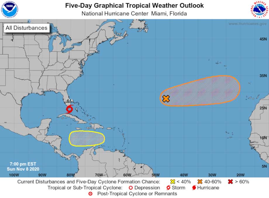
Two new systems have the possibility for development into tropical cyclones over the next five days. A system over the central Atlantic will strengthen with a 40 percent chance of development by the end of the week. Another system in the central Caribbean Sea has a 30 percent chance of forming a tropical cyclone. If either system reaches tropical storm strength, it will break the record for the most named storms in a single season.
The next Greek letters on the list of names are Theta, Iota, and Kappa. With three weeks left in the most active season in history, there is plenty of time left for more storms to form in the 2020 Hurricane Season.
NHC Director Ken Graham provided another Facebook briefing on Tropical Storm #Eta after the 4 pm EST advisory.
— National Hurricane Center (@NHC_Atlantic) November 8, 2020
Watch here: https://t.co/3ekyGJMntG pic.twitter.com/JAmW7KO3ec

