
Tropical Storm Warnings and Hurricane Watches Issued. Outages–Storm Surge–Flash Flooding Expected
NOAA forecasters identified a weather system over Tennessee as having the potential to become a tropical cyclone—an unusual circumstance. Most Atlantic and Gulf tropical storms and hurricanes begin as small storms coming off the coast of Africa or the southern Gulf of Mexico. Barry started out in Tennessee and moved from the southeastern United States to Florida over the next few days.
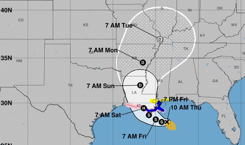
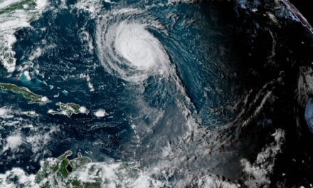
From July 9to July 10, the system moved out of Florida into the Gulf and began to strengthen and organize. This morning, the NOAA National Hurricane Center named the newly formed Tropical Storm Barry. Barry is taking a U-Turn and heading back into the states on Saturday morning. It may have just enough time to reach hurricane strength before landfall. As it approaches land, Barry will impact Louisiana with exceptionally heavy rain. Arkansas, Mississippi, Missouri, and Tennessee can also expect substantial rain through Tuesday.
Hazards from Hurricane Barry include Storm Surge of three to six feet near the Mississippi River Delta region and flash flooding from heavy, sustained rain. Power Outages are always expected as a Hurricane or Tropical Storm makes landfall and additional outages occur as the storm moves inland.
Top 10 Tips to Survive a Hurricane
Tropical Cyclone Barry Impacts
National Hurricane Center Director Ken Graham noted that Barry is a very large storm. It encompasses the entire northern Gulf of Mexico and drifts north by northwest at 5 MPH. Most of the impacts predicted are water related with 15 to 20 inches of rain after landfall and localized amounts up to 25 inches.
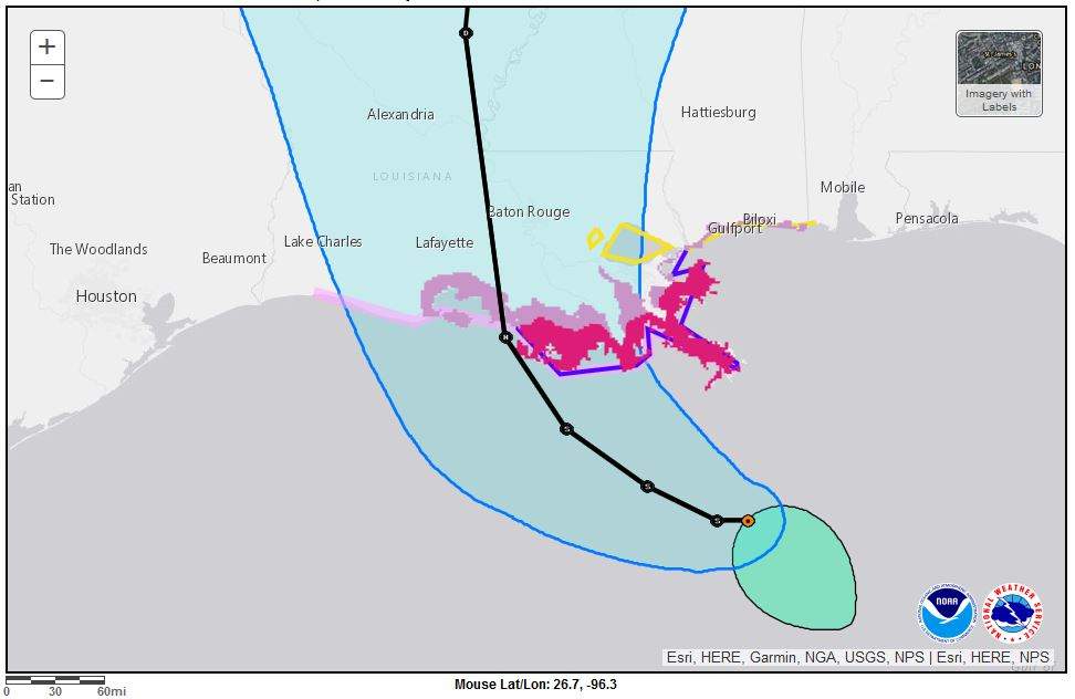
Residents should prepare for a high risk of Flash Flooding as the storm makes landfall near Morgan City, Louisiana with the highest storm surges to the East. A tropical storm warning is in effect and a hurricane watch issued.
Director Graham noted that regardless of the storm’s development (into a strong tropical storm or a category one hurricane) water is the biggest impact. In the last three years, according to Graham, “83 percent of fatalities due to water, half in vehicles.”
A key message from the NOAA and FEMA restates a now familiar adage. If you encounter flood waters, “Turn Around. Don’t Drown.”
Emergency Home Evacuation Plan for Hurricanes and Tropical Storms
Key Messages from the National Hurricane Center
Barry to bring storm surge, rainfall, and wind hazards to the central Gulf Coast during the next few days.
Life-threatening storm surge and inundation along the coast of southern and southeastern Louisiana. The NHC issued a storm surge warning with the highest surge between the Atchafalaya River and Shell Beach. Residents should listen to advice from local officials.
A tropical Storm Warning and Hurricane Watch are in effect for much of the Louisiana Coast. Additional Watches and Warnings to come later today (July 11, 2019.) Residents in these areas should review and put their hurricane action plan in place.
The slow movement of Barry will bring an extended period of heavy rainfall along the central Gulf Coast and inland along the lower Mississippi Valley through the weekend and into next week. Flash Flooding and river flooding becomes likely, sometimes significant, along and east of the system’s track.
Preparation
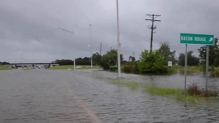
Storms like Barry don’t appear very powerful, but they can cause significant damage and threaten the lives of those they impact. When two feet of rain falls over a relatively short period, it can’t just soak into the ground. Instead, it finds the easiest path to the lowest point and follows it. Overflowing waterways, flooded roads, and homes submerged in water are the result.
Storm Surge is like a strong river current, except the river is everywhere. It can carry cars into deeper water and sweep the unsuspecting off their feet. It starts ahead of landfall and continues as the storm moves inland. In recent years, storm surge and flooding caused 83 percent of all tropical cyclone fatalities, and 50 percent of those fatalities occurred in vehicles.
Pay attention to local information and officials. Prepare to evacuate—before the storm makes it impossible to leave.
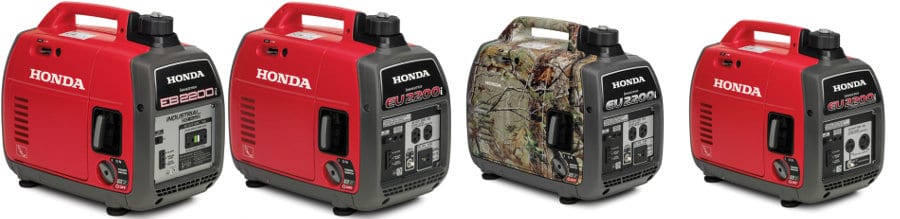
Prepare ahead of time with a store of supplies and water. Water pumps can keep homes dry, and electric generators provide power during outages. Standby generators run for more than a week on natural gas or propane before they need maintenance. They keep the A/C on and the food cold in your refrigerator. Portable Generators fill in as a temporary solution but need a steady diet of gasoline. Usually the maintenance period is 3-5 days instead of a week or more.Portable Generator Safety Rules to Live By


