Update October 11, 8:00 AM EDT
Hurricane Matthew is gone, but the damage left in it’s wake is still affecting residents in five states. Utility crews work to restore power to the widespread outages across five states that left 3.3 million people without electrical power. As of Monday morning, there were still more than one million people without power.
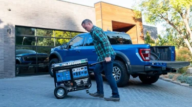
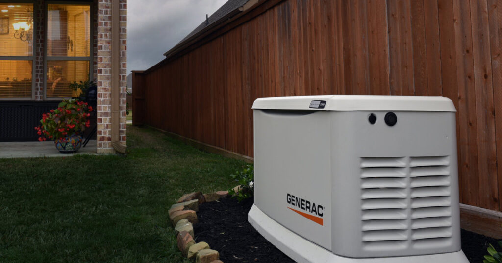
Meanwhile, the death toll continues to rise as at least 23 deaths were attributed to Matthew. Remember to follow all safety rules when using portable generators. Never use a generator or any machine powered by an engine indoors. Keep generators at least 10 feet from the home and away from any doors, windows, or vents.
Authorities remind residents to beware of unlicensed contractors. Check licenses and insurance before hiring anyone.
Stay away from downed power lines and approach fallen trees carefully.
Beware of flooded roads that could hide other hazards. It only takes inches of fast-moving water to wash your car away. Flooding remains a concern in many areas and especially along rivers and other waterways. Evacuations of residents from rooftops were still taking place on Monday.
Update October 7, 1:00 PM EDT
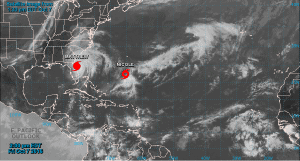
Hurricane Matthew brushes along the coast of Florida as it heads north.
Nearly 1 million Florida residents are without electrical power and Gov. Rick Scott warns that the storm is still causing outages. If you are using a portable generator for emergency backup power, remember to follow safe practices and keep the generator at least 10 to 20 feet away from your home. Stay away from downed power lines as many are live and present a serious, life threatening danger.
Hurricane Matthew continues to travel northward and is brushing the Florida coast on its way toward Georgia and South Carolina. Although gradually weakening, it is still a dangerous category three storm packing winds of 120 MPH.
Warnings and Watches
- The hurricane warning is now in effect from Cocoa Beach, Florida to Surf City, North Carolina.
- A hurricane watch is issued from Surf City to Cape Lookout, North Carolina.
- A tropical storm warning for Sebastian Inlet to Cocoa Beach, and from Surf City north to Duck, North Carolina. The Pamlico and Albermarle Sounds are also under a tropical storm warning.
- Tornado Warnings for Georgia.
Update October 6, 1:00 PM EDT
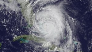
Hurricane Matthew approaches the Florida Coast as a Category 4 Hurricane.
(GOES Satellite Image)
Matthew has strengthened to a Category 4 hurricane as it batters the Bahamas on its way to Florida. It is forecast to reach West Palm Beach with 140 to 145 MPH winds. The NHC has extended the hurricane warnings up the coast through Edisto Beach South Carolina, and the hurricane watch area now extends from Edisto Beach to South Santee River South Carolina.
Scroll Down for Evacuation Routes and Online Resources.
Storm surge for most of the coastline is expected to reach 3 to 10 feet.
The NOAA advises that if you are within the Hurricane Warning Area, do not leave the safety of your home unless instructed by officials to evacuate. The winds are deadly and carry debris that could severely injure or kill. If you are within the watch area, pack up your pets, medicines, the deed to your home, and other emergency items and get out.
Update October 5, 5:00 PM EDT
Matthew is expected to remain a category 3 cyclone or perhaps strengthen to category 4 before it reaches Florida. Evacuation efforts are under way in Florida, Islands off the Georgia Coast, and South Carolina.
Storm surge, which is the most dangerous hazard of a tropical cyclone, may peak at eight feet if it coincides with the high tide. Coupled with high surf conditions it can bring deadly flooding in just moments. If you are in a coastal evacuation zone, leave as soon as possible.
Changes to Watches and Warnings
- The Hurricane Watch has been extended northward from Fernandina Beach to Savannah River.
- A Tropical Storm Watch has been issued for the Florida Gulf Coast from north of Chokoloskee to Suwannee River.
Update: October 5 12:00 PM
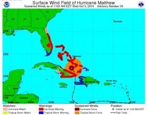
Warnings and Watches issued for Matthew as of noon EDT on Wednesday, October 5 2016
National Hurricane Center Image
Hurricane Matthew continues to bear down on the Atlantic coastline and will affect Florida, Georgia, South Carolina, and North Carolina. Hurricane warnings are issued for Florida and states further up the coast will follow. Matthew will reach Florida as a dangerous category 3 or category 4 hurricane. A State of Emergency exists from Florida to North Carolina and Evacuation Orders are given in all four states. Gasoline supplies are dwindling and some stations have already run out of fuel.
Schools are closing and events are canceled.
Hurricane Warning – The storm is approaching within 24 to 48 hours
- North of Golden Beach to the Flagler/Volusia county line
- Lake Okeechobee
Hurricane Watch – The storm is expected within 48 to 72 hours
- Chokoloskee to Golden Beach
- Florida Keys from Seven Mile Bridge eastward
- Florida Bay
(Note: As Matthew progresses up the coast, watch areas are likely to become warning areas.)
Tropical Storm Warning – The storm is expected within 24 to 48 hours
- Florida Keys from Seven Mile Bridge eastward
- Florida Bay
Evacuation Routes
- Florida Evacuation Routes
- Georgia Evacuation Routes
- South Carolina Evacuation Routes
- North Caroline Evacuation Routes
Do not delay. If you are in an evacuation area, make any last minute preparations quickly. Take your families and pets, and leave.
As the storm reaches the coast, the National Hurricane Center will issue additional warnings and watches. Listen to local radio and television and government emergency websites for up-to-date information.
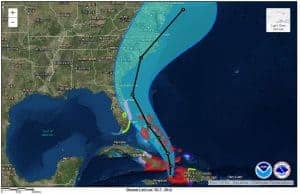
Hurricane Matthew projected path with watches and warnings.
(Image by NOAA)
Original Story
Florida governor Rick Scott declared a State of Emergency on Monday for the entire state of Florida in order to start emergency preparations. Matthew is currently a powerful and dangerous Category 4 hurricane with sustained winds of 145 MPH and gusts to 175 MPH. This storm will likely brush by the Florida Coast as a Major Hurricane.
Residents along the Florida Atlantic Coast and inland from the coast should prepare for the arrival of the storm within the next 48 hours.
This page will be updated as further information becomes available.
The tropical storm watch extends from Key West to Boca Raton and for Lake Okeechobee. A hurricane warning extends from Boca Raton to Titusville.
A tropical storm watch or hurricane watch is issued 48 hours in advance of the tropical storm or hurricane force winds. Warnings are issued when the arrival of the storm becomes imminent.
Warning: Hurricane Matthew is a powerful and dangerous hurricane with winds as high as 175 MPH. It will likely reach Florida as a Category 4 or very strong Category 3 storm. If you live in the watch area, make plans to leave before the storm arrives.
Potential Hazards
Tropical storm conditions are likely to spread over the Florida watch area early on Thursday. Hurricane conditions become very likely late Thursday and will continue through Friday as Matthew moves north along the coast. Additional watches and warning are probable.
Storm hazards include Storm Surge, Inland and Coastal Flooding and Extreme Winds.
- Up to ten inches of rain may cause localized inland flooding—do not drive across flooded roadways.
- Hurricane force winds extend 60 miles from the hurricane center.
- Tropical storm force winds extend 185 miles from the center.
- As Matthew approaches Florida, expect dangerous surf conditions and rip currents.
- High waves will raise water levels in advance of the storm. Storm surge depends on the timing and tide conditions. More information will be issued as the storm approaches.
Prepare Now
Governor Scott signed the executive order declaring the State of Emergency in order to make resources available. Residents should put their emergency preparedness plan into effect.
Prepare for the arrival of the hurricane now:
- Review your emergency evacuation route at FloridaDisaster.ORG in case evacuations orders are given.
- Remove all loose objects from the yard and surrounding area.
- Cover windows with plywood.
- Check your emergency supply kit.
- Restock any supplies that are low or used up.
- Stay turned to local and state news for updates.
- Service your standby generator and check maintenance supplies.
- Purchase extra fuel for your portable generator and restock maintenance supplies.
- Fuel your vehicles.
If you live in an area where evacuations are likely, prepare and leave in advance of the evacuation to avoid delays and clogged roads.


