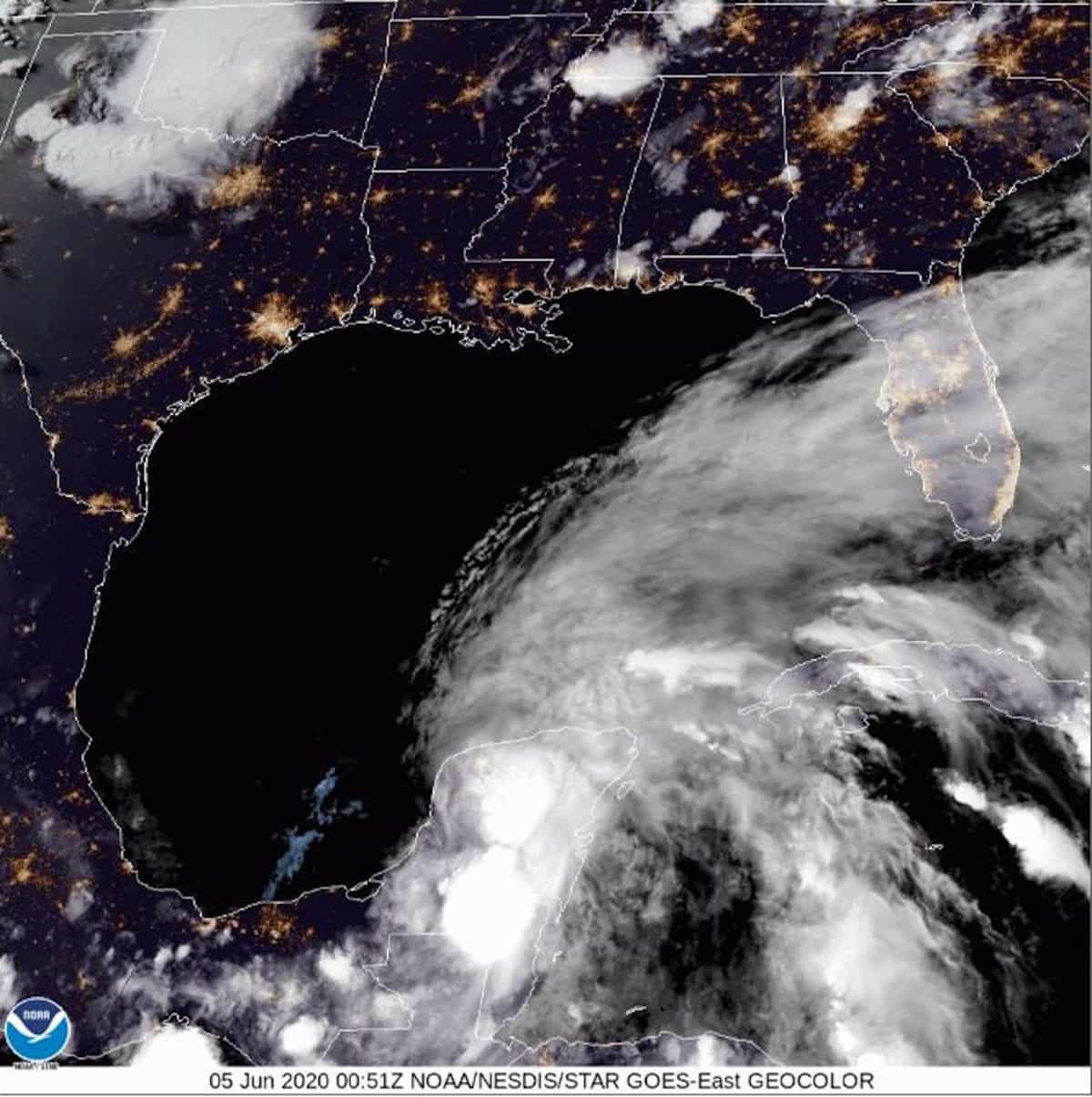
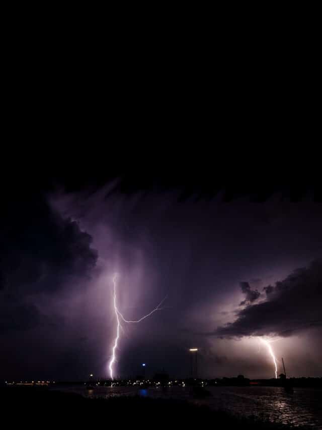
Hurricane Debby—approaches the Florida Big Bend Region.
August 4, 2024 2:00 PM EDT. CIRA/NOAA Geocolor GOES East Satellite Image
Hurricane Debbie Made Landfall Monday Morning
Update August 6, 2024, 4:00 PM EDT
Debbie is moving offshore over the Atlantic. It will move east for the next 24 hours before turning north for a second landfall on South Carolina around midnight August 7-8. Current Forecast from the NHC puts landfall between Pineland and Moores Corner with sustained winds of up to 60 MPH and up to 16 inches of heavy rain.
Portable Generator Safety After a Hurricane
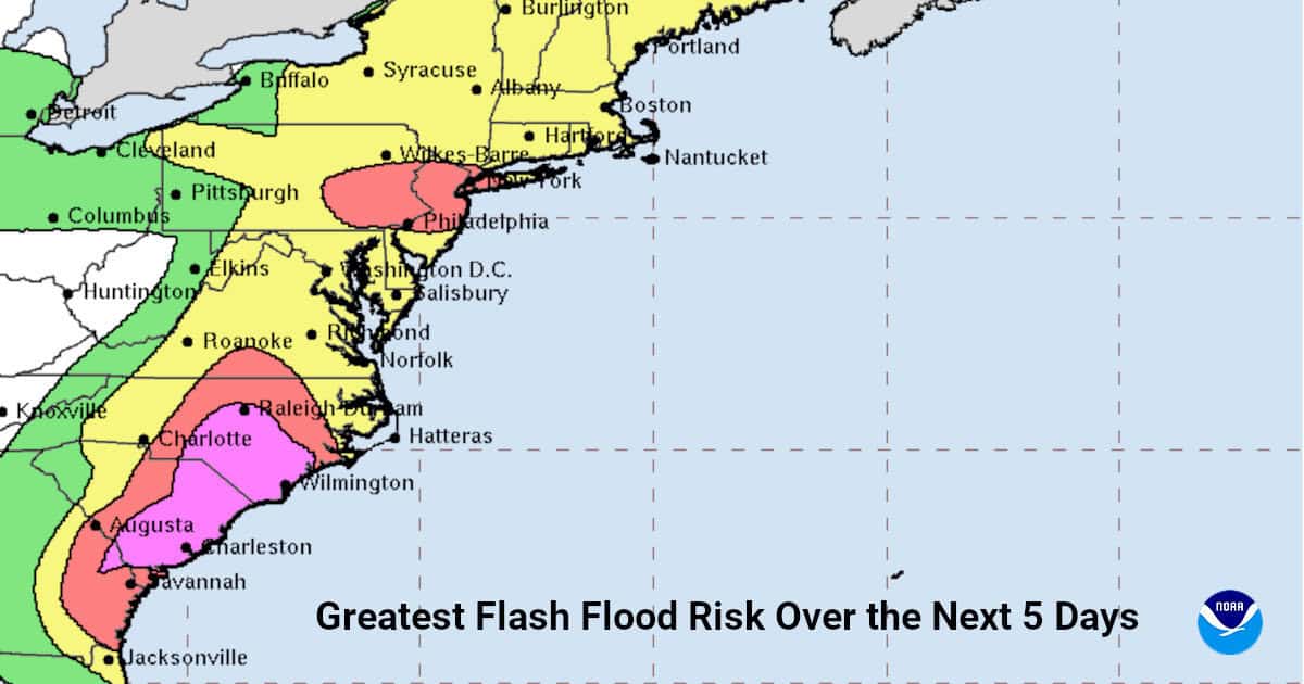
- Heavy rainfall will potentially result in areas of catastrophic flooding. Flooding expected from North Carolina to the Mid-Atlantic and Southern New England through Sunday.
- Dangerous Storm Surge will spread north from northeast Georgia to North Carolina through Thursday. Storm Surge and Tropical Storm watches and warnings are in effect.
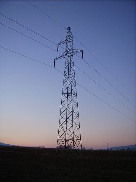
- Deadly hazards remains in portions of Florida, including downed power lines and flooded areas.
Residents of Florida, Georgia, South and North Carolina should Continue to Monitor the progress of the storm and follow advice given by local authorities.
Update: Monday August 5, 2024
Hurricane Debby Brought Storm Surge and High Winds to the Florida Coast when it made landfall in the Big Bend Region. It is expected to remain a tropical storm with with sustained winds of 45-60 MPH as it crosses North Florida, Georgia, and South Carolina. Debby should move offshore sometimes on Tuesday and skirt the coast as it regains strength before making a second landfall on northern South Carolina.
Heavy rain up to 30 inches will bring potentially catastropic flooding to flood-prone regions in the three states.
Florida, Georgia, and South Carolina Should Expect:
- Flooding from Florida to the Coastal Plains of South Carolina Through Saturday Morning
- Dangerous Storm Surge will Continue Along Gulf Coast Through Monday Afternoon.
- Tropical Storm Conditions will Persist Along the Gulf Coast on Monday.
- Dangerous Storm Surge and Tropical Storm Conditions will spread along the southeast coast from Florida to North Carolina through the middle of the week. Storm Surge and Tropical Storm Warnings are in Effect with Additional Watches and Warnings coming today.
August 4, 2024, 2:00 PM EDT
Debby is located approximately 100 miles south southeast of Tampa Bay. Tropical Storm Force Winds extend 150 miles west, north, and south of the storm center.
Tropical Storm Debbie will hit the Florida Big Bend region Monday Morning as a strong category 1 Hurricane, bringing life-threatening storm surge up to 10 feet. A Hurricane Warning is in effect for the Florida Big Bend Region. Other Watches and Warnings in Effect.
Follow the National Hurricane Center and Local Weather for Updates. Listen to and Follow Advice from Local Officials. Use Florida Emergency Management Disaster Website.
National Hurricane Center Key Messages
- Heavy rainfall from the Florida Big Bend region through southeast Georgia, and South Carolina—potentially historic for Georgia and South Carolina—may result in catastrophic flooding and river flooding.
- The NHC’s Peak Storm Surge Graphic shows inundation of 6-10 feet above ground level between the Ochlockonee River and Suwannee River on Monday. Follow Advice Given By Local Officials!
- Hurricane Conditions expected along the Florida Big Bend. A Hurricane Warning is in effect with Tropical Storm Conditions expected Sunday Evening. Tropical Storm Conditions expected along the entire Florida West Coast Through Monday, including the Tampa Bay area.
- Storm Surge Impacts along the Georgia and South Carolina coast through the middle of the week. Storm Surge and Tropical Storm Watches issued for Georgia and South Carolina.
Debby began as a tropical wave west of the Greater Antilles around July 26. As followed a path over the islands from the Antilles through Cuba, it became better defined and was designated Potential Tropical Cyclone Four on August 2. That night, the NHC upgraded it to Tropical Depression Four. After moving over the Gulf of Mexico, it further intensified to a Tropical Storm and was named Debby, the fourth named storm of the 2024 Atlantic Hurricane Season.
If you are sheltering in place for #Debby, stay indoors to avoid endangering yourself or first responders. Let you family and friends know your safe, if possible. Stay on top of weather updates & safety information to know when it's safe to leave your home. pic.twitter.com/rEtAdiiYjn
— FEMA (@fema) August 6, 2024
South Carolina & Georgia: Finish your last-minute preparations NOW before Hurricane #Debby reaches your area. Gather supplies, charge your devices, and #BeReady for heavy rains and flash flooding.
— FEMA (@fema) August 5, 2024
More ⬇️ pic.twitter.com/32fM2F1ya1
Hurricane #Debby is bringing catastrophic flooding in communities across Florida, South Carolina, & Georgia. Quick tips to keep yourself safe. ⏬ https://t.co/e5TPKLDuOp
— FEMA (@fema) August 5, 2024
UPDATE: Tropical Storm #Debby is currently bringing 2 - 4 feet of storm surge to Southwest Florida. These are pictures of flooded Fort Myers Beach right now. Credit: Beach Talk Radio @WINKNews @stormhour @spann pic.twitter.com/kGgwNEiu95
— Matt Devitt (@MattDevittWX) August 4, 2024
🌀 #TropicalStormDebby to Hit #Florida Big Bend on Monday as #HurricaneDebby with 6-10 Feet of Storm Surge and 90 MPH Winds Gusting to 110MPHhttps://t.co/VV3z4awKLB pic.twitter.com/2aTZLakHzD
— Norwall PowerSystems (@NorwallPowerSys) August 4, 2024
#Hurricane #Debby threat shifts to catastrophic flooding from #Florida to @SouthCarolina and #Georgia as up to 30 inches of rain expected to fall on flood-prone regions—Debby should persist as a tropical storm through the next 4 days.https://t.co/SiwsfwYTsl pic.twitter.com/ADTZl492QC
— Norwall PowerSystems (@NorwallPowerSys) August 5, 2024
As #Debby brings heavy rainfall, remember:
— Readygov (@Readygov) August 5, 2024
❗ Do not walk, swim, or drive through flood waters. Turn around, don’t drown!
❗ Never drive around barricades. Local responders use them to safely direct traffic out of flooded areas.https://t.co/tS3S0PGy2L pic.twitter.com/VY1cDdDMsB
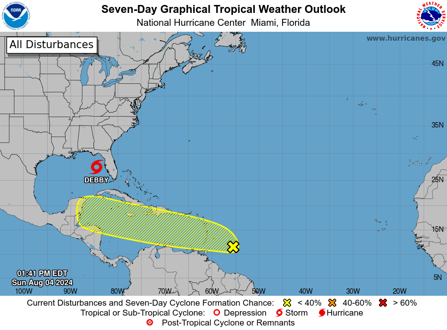
Hurricane Preparedness
Norwall Resources
- Hurricane Hazards and Risk Factors
- Make a Hurricane Evacuation Plan
- Hurricane Preparedness Kits and Supplies
- Hurricane Insurance Checkup and Updates
- Prepare Your Home for Hurricanes
- Help Neighbors with Hurricane Preparedness
- Complete Your Hurricane Preparedness Plan
- Emergency Preparedness Tips
- How to Prepare for a Power Outage
- 10 Tips to Survive a Hurricane Disaster
- FEMA Recommends a Generator
- Hurricane Disaster Preparedness
Did You Know:
Hurricanes and Tropical Storms Destroy Local Power Grids and Transmissions Systems. FEMA Recommends a Backup Power Source
In Stock Portable Generators
Ready to Ship
Ernesto Could Be Following on Debby’s Heels
The NHC had begun tracking a new tropical wave a few hundred miles east of the Windward Islands with winds to 35 MPH. Favorable conditions will allow slow strengthening and organization as it moves through the Caribbean Sea over the next week. If the system organizations into a tropical storm or hurricane, it could be named Ernesto.

