
Storm to Make Landfall as a Category 3 Major Hurricane with 120 MPH Wind – Storm Surge
Update October 10, 2018
Hurricane Michael Made Landfall Today with 155 MPH sustained winds and a central pressure of 918 mb – not quite a Category 5 Major Hurricane. Michael will remain a hurricane as it travels north, gradually diminishing in strength. It is expected to retain Category 1 strength until reaching central Georgia.
This hurricane will remain a dangerous storm as it travels across the Southeast States until it finally emerges over the Atlantic Ocean sometime Friday off the coast of North Carolina. Expect impacts from high winds and flooding due to torrential rains.
Update: 2:30 PM October 9, 2018

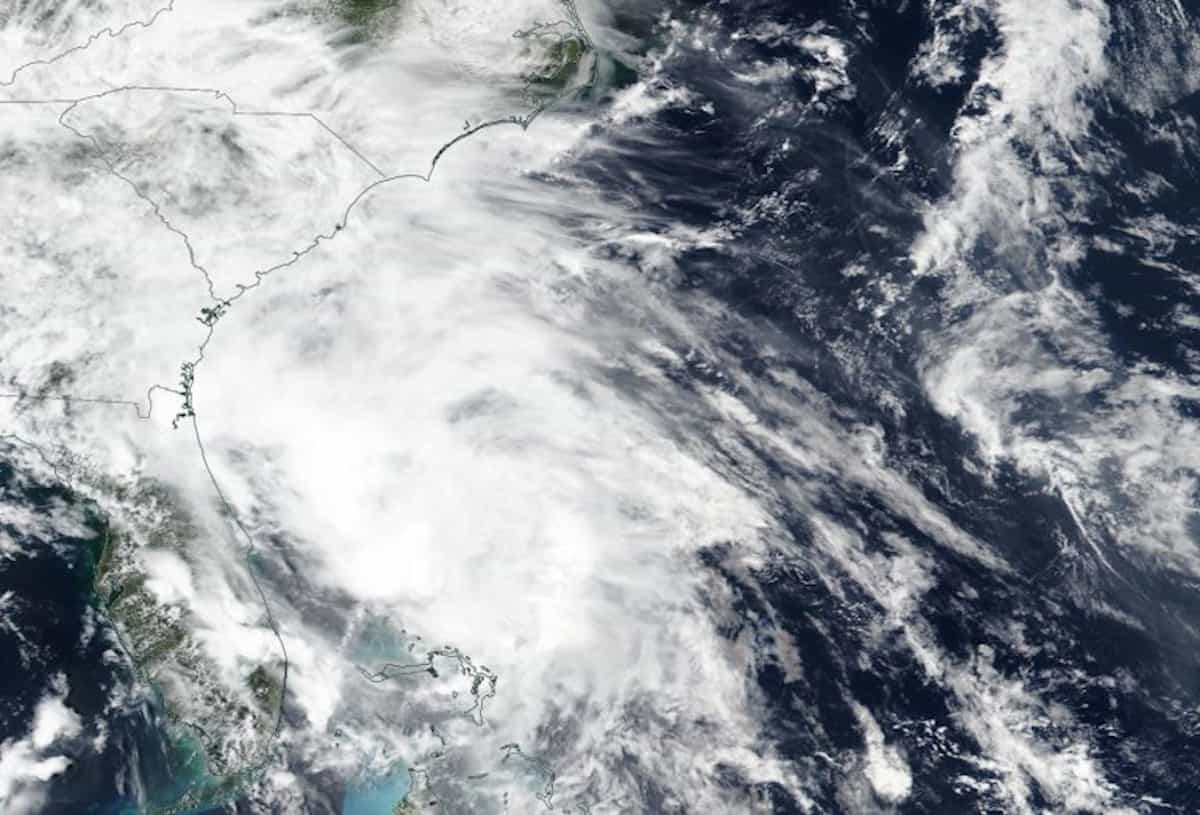
Hurricane Michael’s Path is virtually unchanged from the previous forecast, although a slightly stronger storm is now expected. ( NOAA – NHC Image 1:00PM CDT )
Except for an increase in expected intensity, the forecast for Hurricane Michael remains essentially the same. At 10:00 AM this morning, sustained winds of 110 MPH were measured by aircraft, just slightly below category 3. Michael will intensify this afternoon through tomorrow and become a Category 3 Major Hurricane with 120 to 125 MPH winds.
Michael is approximately 24 hours away from landfall. Dangerous Surf Conditions and Rip Current Warnings are in effect along with flash flooding, flood warnings, and storm surge warnings. Tornadoes are possible. After landfall, Michael will remain a strong Tropical Storm with winds up to 60 MPH as it travels through the southeast U.S. until it emerges over the Atlantic after passing through North Carolina.
Key Messages from the NHC:
- Complete preparations today as it will become dangerous tomorrow. Those evacuating should have already left.
- Expect dangerous, life-threatening storm surge up to 12 feet that travels far inland along low-lying areas, rivers, lakes, and waterways.
- Hurricane-force winds will occur all across the Florida Panhandle well inland and extend to southeast Alabama and southwest Georgia.
- Heavy rain will cause flash flooding from the Florida Panhandle all the way to North Carolina.
— End Update —
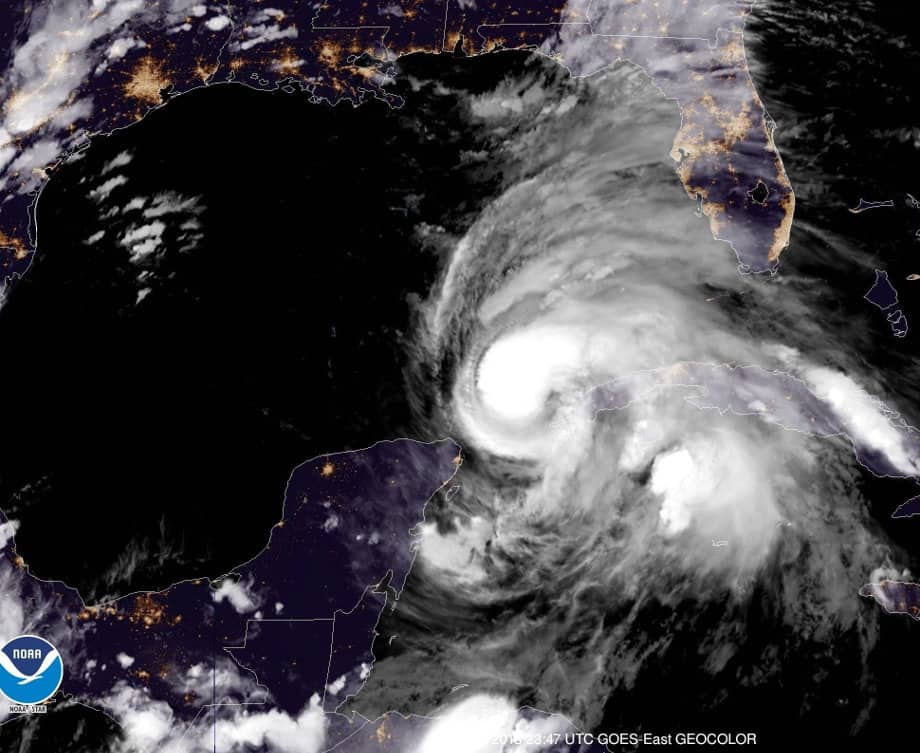
A GOES East Satellite Image of Hurricane Michael as it intensifies near Cuba on October 8, 2018 (NASA Image)
#HurricaneMichael is rapidly growing into a strong, dangerous storm that will make landfall sometime on Wednesday, probably around the Apalachicola area of the west Florida Gulf Coast, but anywhere east of Pensacola along the Florida Panhandle.
What began as a broad area of low pressure on October 2 over the Caribbean Sea has rapidly grown into Hurricane Michael, now headed for the West Florida Gulf Coast and expected to make landfall on Wednesday. The National Hurricane Center has issued a Hurricane Warning from Pensacola on the west to the Tampa Bay area on the East.
Forecasters expect Michael to strengthen over the next 24 to 36 hours and reach land with sustained winds of up to 120 MPH.
All Residents, both along the coast and inland, should hurry to finalize preparations in advance of the storm. Tropical Storm Force winds (39 MPH to 74 MPH) begin arriving late Tuesday and will make further preparation difficult and dangerous, according to NHC Director Ken Graham in his live update given earlier today (10/8) at 1:00 PM EDT.
Hurricane Preparedness – When a Hurricane Threatens
Hurricane Michael Hazards

Storm Surge from Hurricane Michael Could Reach Inland up to 30 Miles Along Rivers and Other Low-Lying Areas
The strong winds associated with Hurricane Michael begin arriving in the warning area sometime in the evening on Tuesday, October 9. Those along the coast should expect strengthening winds and worsening surf conditions throughout the day. High waves and the associated Rip Currents from the approaching storm will make beach conditions hazardous.
Forecasters expect Michael to make landfall on Wednesday with Category 3 winds up to 120 MPH. The accompanying storm surge up to 12 feet could reach more than 30 miles inland along rivers. Fanning Springs was one area cited by Director Graham as one example of how far the 9-foot surge could reach inland.
All of the rivers and low-lying areas all along this portion of the coast are particularly vulnerable to the storm surge that will accompany Hurricane Michael as it nears land. Current expectations indicate up to 9-12 feet of surge near Apalachicola and 4-6 feet at the outlying areas of the hurricane warning area. Residents along rivers should expect the surge to reach far inland as the tributaries reverse direction and the water rises with the surge.
Portable Generator Safety Rules to Live By
A portion of Hurricane Michael’s circulation will remain over water as it travels inland through Florida, Georgia and into South and North Carolina before emerging over the Atlantic Ocean sometime late Thursday or Friday. Circulation over warm ocean water will allow Michael to retain tropical storm characteristics including high winds and torrential rains.
Danger – Never Backfeed Your Home with a Portable Generator
Preparation

Official Expect Widepread, Extended Power Outages After Hurricane Michael
Florida Governor Rick Scott has requested a pre-disaster declaration from President Trump which will free up Federal Funds for disaster relief. Scott has extended the State of Emergency declaration to 35 counties. Hurricane Michael Information – FloridaDisaster.ORG (Follow on Twitter @FLSERT )- has additional information and links directly related to Hurricane Michael. Bookmark important links on your Mobile Devices for fast, easy reference.
Mandatory Evacuation orders are in effect for some areas, and voluntary or phased evacuation orders for other areas. If you are in an evacuation zone, hurry to complete preparations for your property and leave along the designation hurricane evacuation routes.
All Non-Residents in the Watch Area are Required to Evacuate
Ten 10 Tips to Survive a Hurricane Disaster
Within the Watch / Warning Area
- Review your hurricane emergency plan and begin taking action now.
- If you are evacuating, leave as soon as possible with your family and pets. Remember that most shelters won’t take pets.
- Bring all movable objects indoors – grills, patio furniture, toys, etc.
- Remove all debris from your property. Trim loose tree branches.
- Close storm shutters, board up windows, reinforce garage and patio doors.
- Fill your vehicle fuel tanks now and keep them full.
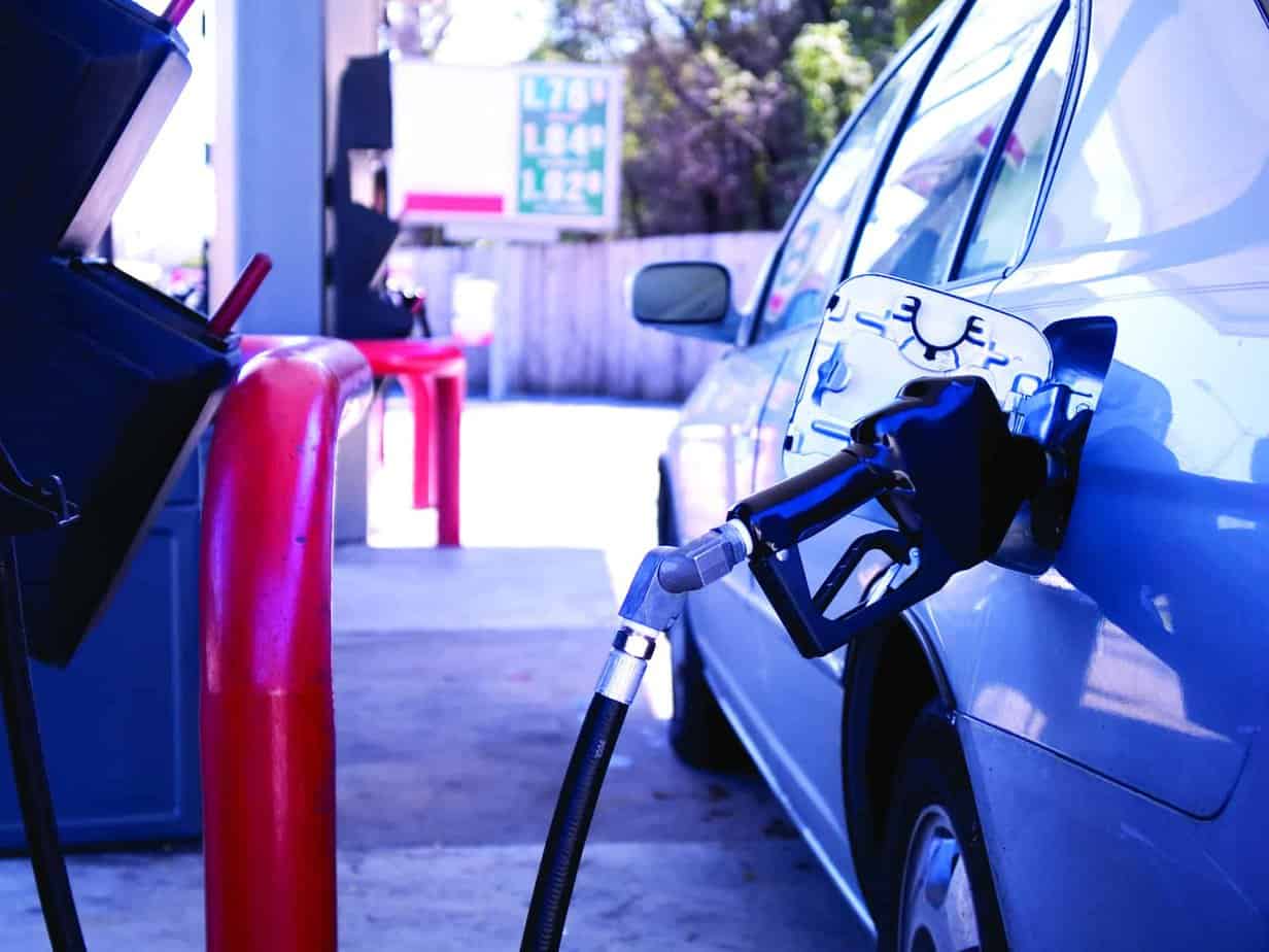
- Check supplies of gasoline/propane for portable generators. Authorities expect widespread, extended power outages.
- Purchase oil and maintenance supplies for standby generators. Perform required maintenance before the storm arrives.
- Stock water and non-perishable food for at least three days. Six to 10 days is better.
- Listen to local news and follow official websites and social media for up to date information.
NHC Director Ken Graham warns that this storm has left little time for preparation. Tropical storm force winds will begin arriving in the warning area by Tuesday evening. Coastal residents should have completed preparations, and those evacuating should leave.
Hurricane Michael is rapidly growing stronger and will be a dangerous, major hurricane when it reaches Florida. Complete preparations – obey evacuation orders.


