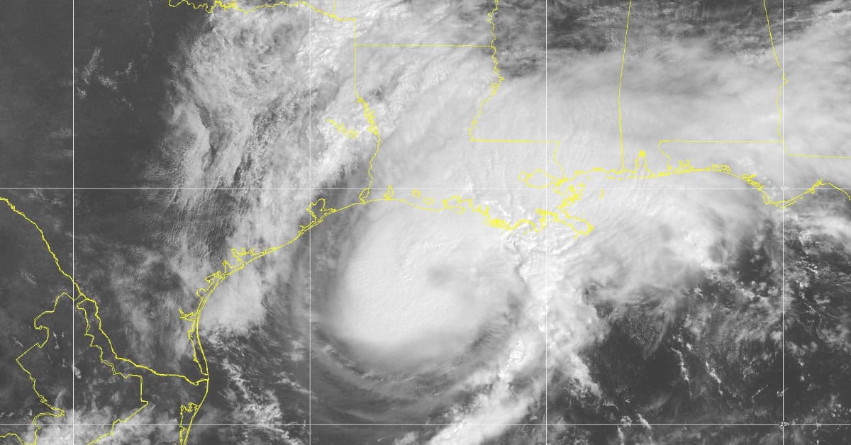
Hurricane Francine Nears Louisiana on September 11, 2024, 11:00 AM Central Time. Sustained Winds at 90 MPH, Gusts to 115 MPH. Storm Surge Warnings up to 10 Feet Expected. Hurricane & Storm Surge Warnings in Effect.
NOAA GOES16 Satellite Image
Hurricane Francine—Storm Surge & Hurricane Warnings In Effect
Update September 11, 2024 11:30 AM.
Hurricane Francine is bearing down on the Louisiana coast. Expect Tropical Storm Force Winds to arrive around 2:00 PM. There is a significant danger of life-threatening storm surge up to 10 feet from Intracoastal City to Port Fourchon, 4-7 feet to the Mississippi River, 2-4 feet to Alabama/ Florida Border and west of Intracoastal city to Cameron. 1-2 feet along portions of the Florida Coast and from Cameron, LA to Freeport Texas.
- Residents within the warning areas should follow advice by local officials and rely on local forecasters and the National Hurricane Center for hurricane updates.
- Be sure you are in a safe place before the strong winds or flooding arrive.
- Francine will bring heavy rain with considerable risk of flash floods and urban flooding to southeastern Louisiana, Mississippi, southern Alabama, and the Florida Panhandle through Thursday night.
- Flash and Urban Flooding is probable for the Lower Tennessee Valley and Lower Mississippi Valley tonight into Friday Morning.
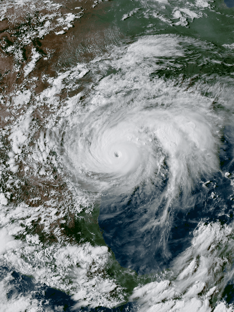
Hurricane Francine September 9
The NHC began issuing watches for Tropical Storm Francine after upgrading Potential Tropical Cyclone Six to a Tropical Storm on Monday, according to the NHC Website. Francine is turning to the northeast as it strengthens and will hit the Louisiana Coast Wednesday Evening.
Hurricane Watches in effect from Texas to the Mississippi River Delta.
Tropical Storm Watches in effect on Gulf Coast of East Texas and along the Mississipi Delta, and Lakes Ponchetrain and Lake Maurepas.
The NHC Issued a Storm Surge Watch from High Island, Texas to the Mississippi-Louisiana border.
National Hurricane Center Key Messages
- Francine will be a hurricane when it reaches the Gulf Coast on Wednesday or Wednesday Night.
- Hurricane Watch in Effect
- Increasing likelihood of life-threatening storm surge for Upper Texas and Louisiana Coastlines—Storm Surge Watch in Effect.
- Follow advice given by local officials
- Increasing risk of damaging winds beginning on Wednesday for southern Louisiana.
- Francine will bring Heavy Rainfall along with a considerable Risk of Flash Flooding far northeast coast of Mexico and portions of the southernmost coast of Texas; the Upper Texas coast, southern Louisiana, and southern Mississippi Coast into Thursday Morning.
- Risk of Flash and Urban Flooding in the Mid South from Wednesday through Friday Morning.
Hurricane Preparedness
- Hurricane Hazards and Risk Factors
- Make a Hurricane Evacuation Plan
- Hurricane Preparedness Kits and Supplies
- Hurricane Insurance Checkup and Updates
- Prepare Your Home for Hurricanes
- Help Neighbors with Hurricane Preparedness
- Complete Your Hurricane Preparedness Plan
- Emergency Preparedness Tips
- How to Prepare for a Power Outage
- 10 Tips to Survive a Hurricane Disaster
- FEMA Recommends a Generator
- Hurricane Disaster Preparedness
9/11 10am CDT: There is a danger of life-threatening storm surge from #Francine today for the Louisiana and Mississippi coastlines, where a Storm Surge Warning is in effect. Residents in the warning area should continue to follow advice given by local officials. pic.twitter.com/DCcs6OXJMC
— NHC Storm Surge (@NHC_Surge) September 11, 2024
Tropical Storm #Francine has formed in the southern Gulf of Mexico - the first Atlantic named storm formation since Ernesto on Aug. 12. The last time that the Atlantic had no named storm formations from Aug. 13 - Sept. 8 inclusive was 1968. pic.twitter.com/q2kvIm6Mkf
— Philip Klotzbach (@philklotzbach) September 9, 2024
In Stock Discount Portable Generators

Norwall has Portable Generators in Stock and Ready to Ship. Full Manufacturer Warranty on Clearance, Discounted, or Scratch and Dent Portable Generator Models. Limited Stock.
1:30 PM Radar Update
— NWS Brownsville (@NWSBrownsville) September 9, 2024
🌀 Tropical Storm Francine is continuing to bring rain to the Deep South Texas coast. Heavy rainfall is possible - be sure to practice flood safety if you encounter water on the roads this afternoon. Turn around, don’t drown!#RGVwx #SPI #txwx pic.twitter.com/h3wDIeqPOY


