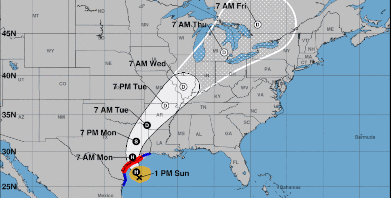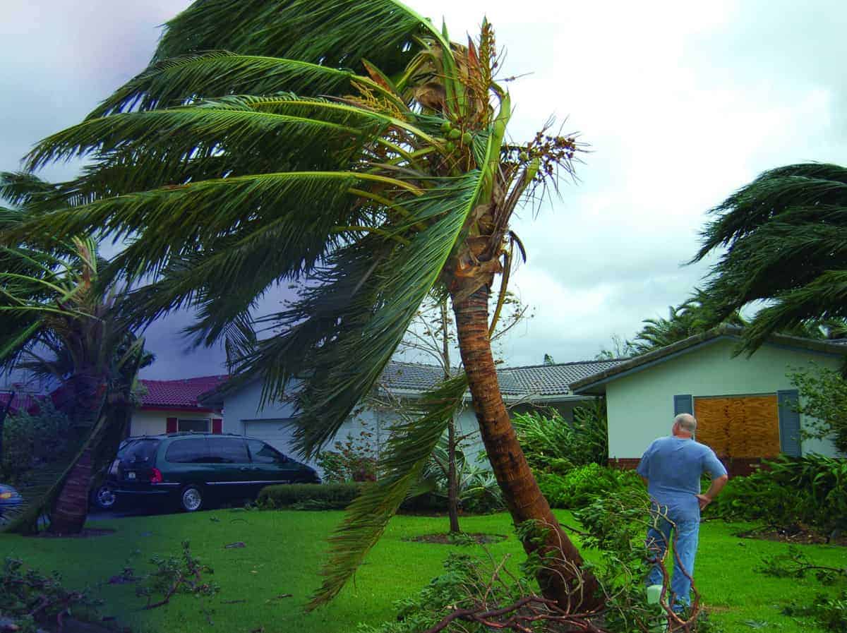
Tropical Storm Beryl is Intensifying and Expected to Reach the Texas Coast as a Hurricane with 85 MPH Winds, Life-Threatening Storm Surge, Flash Flooding, and Inland Flooding. Rush Preparations to Completion Before Nightfall. NOAA-NHC Graphic.
Tropical Storm Beryl Strengthenging To Hurricane. Rush Preparations
Latest: July 7, 1:40PM CDT
Hurricane Warming in Effect. Rush Final Preparations before Tropical Storm Conditions Reach the Coast Later Today.
Follow Advice of Local Officials—Including Evacuation Orders.
Stay tuned to Local Weather and the National Hurricane Center for Updates.
Tropical Storm Beryl is entering a region conducive to further strengthing with little wind shear over very warm watern. Futher intensification is expected. Brownsville radar shows an eyewall forming and Satellite images indicate deep convection becoming more symetrical around the center
Beryl will continue to intensify up until landfall.
Rush Preparations before storm conditions reach the coast.
Hurricane Preparedness
- Hurricane Hazards and Risk Factors
- Make a Hurricane Evacuation Plan
- Hurricane Preparedness Kits and Supplies
- Hurricane Insurance Checkup and Updates
- Prepare Your Home for Hurricanes
- Help Neighbors with Hurricane Preparedness
- Complete Your Hurricane Preparedness Plan
- Emergency Preparedness Tips
- How to Prepare for a Power Outage
- 10 Tips to Survive a Hurricane Disaster
- FEMA Recommends a Generator
- Hurricane Disaster Preparedness
Latest: July 2, 2:30PM EDT
Hurricane Beryl’s Outer Bands Lash Hispanola with Storm Force Wind—Heavy Rain
- There is considerable uncertainty in track and intensity forecasts beyond Friday. Beryl could strengthen again over the warm Gulf of Mexico water, and some guidance models forecast a turn to the north. Gulf Coast residents including Texas should remain alert and monitor the storm.
- Accuweather forecasts a turn to the north with possible landfall on the Texas Gulf Coast on Monday, July 8.
- Beryl reached Category 5 strength Monday night, the earliest category 5 storm recorded. It has since weakended slightly, but remains a dangerous storm.
- Jamaica and the Cayman Islands expect hurricane force winds, life threatening storm surge, and damaging waves Wednesday and Wednesday Night.
- Residents in Jamaica and the Cayman Islands should heed local government and emergency management for preparedness and evacuation orders.
- Heavy rain and flooding expected in Jamaica and Southern Hispanola through late Wednesday.
- Beryl should gradually weaken to category 1 or category 2 by the time it landfalls on the Yucatan Peninsula and Belize late Friday.
Here are the Key Messages for Sunday morning for strengthening Tropical Storm #Beryl. Full advisory: https://t.co/tW4KeGdBFb pic.twitter.com/ZZ9qaOeBMu
— National Hurricane Center (@NHC_Atlantic) July 7, 2024
Here is our latest briefing on Beryl and its forecasted impacts for Southeast Texas. Its expected to bring all hazards potentially to portions of the area. High winds, storm surge, flooding rains, isolated tornadoes. #txwx #TSBeryl https://t.co/UZfEHTSSMH
— NWS Houston (@NWSHouston) July 7, 2024
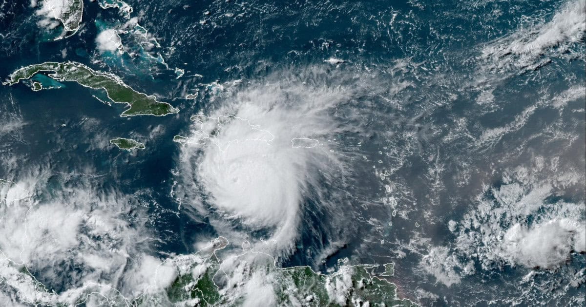
Category 4 Hurricane Beryl Lashes Southern Hispanola with Tropical Storm Force Winds, Heavy Rain, and Life-Threatening Flooding. NOAA GOES 16 Satellite Image. July 2, 2024 20:30Z
Category 4 Hurricane Warnings Issued for Windward Islands
Latest: June 30, 1:30 PM EDT
- Storm Warnings issued for Windward Islands. More Warnings to Come
- New Disturbances over SE Atlantic and SW Gulf of Mexico Could Become Tropical Storms Chris and Debby
- Beryl to Reach Gulf of Mexico by Next Weekend
In an area of unusually favorable conditions for the end of June, scattered thunderstorms south of Cabo Verde began organizing on from June 25. Tropical Depression Two on the 28th. Six Hours later, it was upgraded to Tropical Storm Beryl. Beryl began rapid intensification and became a hurricane on Saturday June 29. The storm continued rapid intensification through Saturday night and reached Category 2. NOAA sent Hurricane Hunter Aircraft to investigate on Sunday morning. The aircraft found Beryl had intensified to a dangerous category 4 hurricane with 120 MPH winds.
The National Hurricane Center issued Hurricane Warnings for the Windward Islands from Grenada to Saint Lucia. Beryl is an extremely dangerous storm and residents should follow advice by local officials. Beryl will land on the windward islands at category 4 with 140 MPH sustained winds.
The NHC has issued a Tropical Storm Warning for Martinique, and a tropical storm watch for Dominica, Trinidad and Tobago.
Residents on these islands should rush to complete preparations today. Expect catastrophic hurricane-force wind, life-threatening storm surge, and damaging waves. Heavy rainfall and localized flooding will take place through Monday.
Beryl will remain a powerful hurricane as it moves across the Caribbean Sea this week.
Days 4 and 5 of the forecast are uncertain. Anyone in the Caribbean between the Windward Islands and Yucatan Peninsula should prepare now for Hurricane Beryl. The storm will also affect Puerto Rico, Dominican Republic, and Haiti. Jamaica (Day3) and the Cayman Islands (Day 4) are within the cone of uncertainty.
Vacationers in Cancun should prepare for Hurricane Beryl to reach the Peninsula early on Day 5, Friday July 5th as a Category 1 or 2 hurricane.
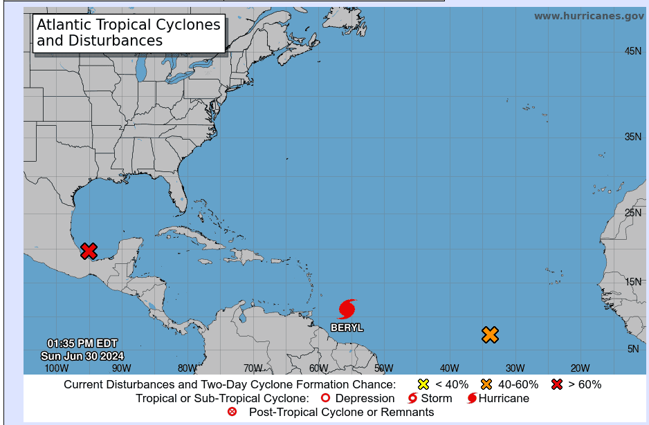
Disturbance 1 in the Southwest Gulf. Disturbance 2 in the South Central Atlantic, and Hurricane Beryl (Category 4) East of the Windward Islands on June 30, 2024. NOAA NHC Graphic
Gulf of Mexico
The forecast beyond Day 3 is uncertain. Most likely, Beryl will reach the Yucatan Peninsula on Friday, July 5th as it begins a slight turn to the north from it’s west by Northwest track. By late Friday or early Saturday, Beryl will emerge over the southwest Gulf of Mexico in or near the Bay of Campeche—perhaps as tropical storm as it continues a turn to the north.
Storm tracks beyond Day 5 have considerable uncertainty. However, at this time, Beryl could easily restrengthen over the very warm water of the Gulf and head anywhere.
Southwest Gulf of Mexico Disturbance 1—80% Chance of Development
The low-pressure system over the far southwest Gulf of Mexico has become better organized and it appears that a tropical depression is forming. It is moving northwest and should reach the east coast of Mexico tonight. The NHC may issue tropical storm warnings for this area later today.
Expect heavy rainfall and flooding across eastern Mexico through Monday. Air Force Reconnaissance is currently investigating the system.
Central South Atlantic Disturbance 2—70% Chance of Development
A tropical depression is likely to form out of Disturbance 2 later this week. Conditions similar to the area that Beryl passed through will likely result in another Tropical Storm that could intensify to a hurricane. The Lesser Antilles should monitor this storm as it follows Hurricane Beryl into the Caribbean.

