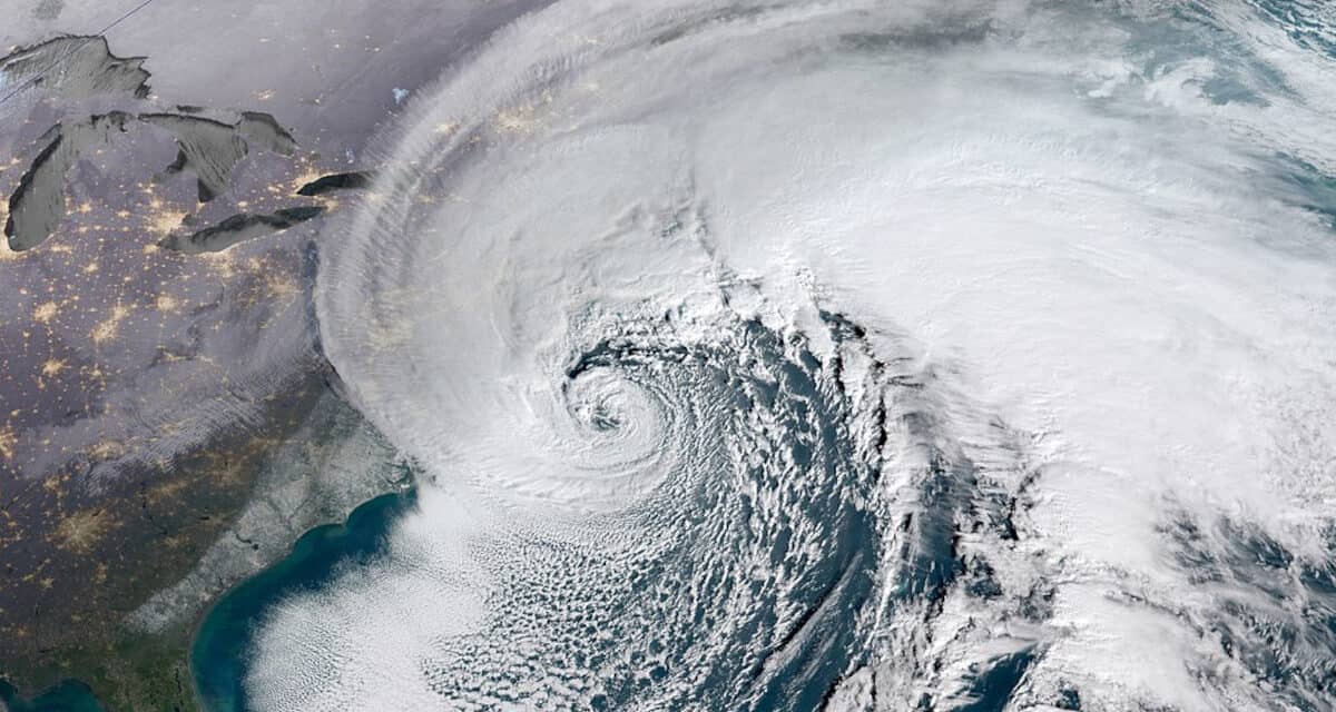
The January 4, 2018 nor’easter with the classic hook or comma shaped cyclone. Warm air moving north meets cold air moving south off the East Coast to form a low pressure region that forms an extratropical cyclone. NOAA Satellelite Image.
Bomb Cyclone Drops Up to 30 Inches of Snow from Virginia to Massachusetts, Leaves Sub-Zero Wind Chills in its Wake
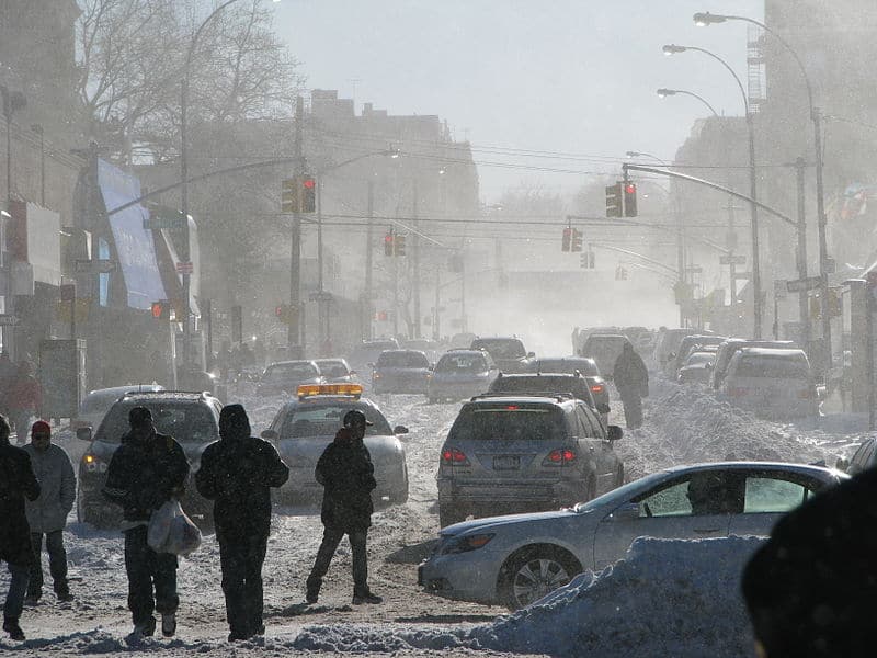
A Nor’easter buried portions of the East Coast in up to 30 inches of snow over the weekend. Cape Cod recorded wind gusts up to 99 MPH according to Reed Timmer, AccuWeather Meteorologist. As the blizzard lost strength, it left sub-zero wind chills behind. Three people lost their lives while shoveling snow. Over 100,000 utility customers lost power on Saturday.
Best Home Generators for Cold Climates
Forecasters watched the storm throughout the previous week as it set up off the East Coast. According to NOAA, the storm covered the entirety of New England with an average depth of 12 inches.
Average doesn’t tell the complete story. Stoughton, Massachusetts, had over 30 inches on the ground while Boston dug out from 23.6 inches—tying their record for the most snow in a single day. New York City received a foot in some places. Long Island Islip Airport had over two feet of snow before it stopped.
While the storm covered states with snow from South Carolina to Maine and all the way to Chicago, unusually cold weather spread south. Florida Keys Marathon International Airport dipped to 46 degrees. In Tallahassee, temperatures plunged below 20 degrees.
Final snowfall reports from the January 28-29, 2022 blizzard. Highest totals by state:
— NWS Eastern Region (@NWSEastern) January 30, 2022
MA-Stoughton 30.9"
NY-Islip 24.7"
RI-Warren 24.6"
CT-Norwick 22"
ME-Veazie 22"
NJ-Bayville 21"
DE- Lewes 14.2"
MD-Ocean Pines 14"
NH-Rye 13.5"
VA-Wallops Island 9.5"
PA-Lower Makefield 9" pic.twitter.com/qIzPHUM4pD

Blizzard Warnings, Winter Storm Warnings , Watches, and Advisories Along the East Coast and also for Chicago for the January 2022 Nor’easter. NOAA Graphic
Nor’Easters—Extratopical Cyclones—Bomb Cyclones
A nor’easter is a non-tropical cyclone that can reach the strength of a hurricane or strong tropical storm. Tropical cyclones get their energy from warm ocean water. Non-tropical storms like the one that hit the East Coast get their energy from the atmosphere.
How to Prepare for a Power Outage
The nor’easter gets its name from the wind direction, typically from the northeast. They occur primarily in late fall or winter along the East Coast. Nor’easters bring powerful wind and coastal flooding with heavy inland snowfall or rain, much like a hurricane or tropical storm would flood the coast and drop heavy rain. Storms that form early may bring torrential rain. Winter storms turn into blizzards or a mix or rain and snow.
Two air masses collide over the ocean, usually less than 100 miles offshore. A stream of cold air moving down from the arctic meets warm air over the Gulf Stream, forming a low-pressure system. The storm’s rotation comes from the jet stream moving warm air rising into the upper atmosphere faster than the air moves at lower levels and from the inertial force of the Earth’s rotation (Coriolis effect). The cyclone sometimes appears to have an eye like a hurricane when viewed on a satellite image, but it is not an eye and is merely a dry area.
If the low-pressure system develops very fast, with a drop of more than 24mb in a day, the storm becomes a “bomb cyclone” because it developed explosively. Meteorologists call the formation of an extratropical cyclone cyclogenesis. Explosive cyclogenesis occurs with the rapid formation of the extratropical low resulting in explosive formation of the cyclone.
Nor’easters are unique to the East Coast of North America with a combination of a north east wind and the extreme moisture content of the clouds. Similar conditions can happen in other places, but with the wind from different directions.
Governors in New York, New Jersey and Massachusetts declared states of emergency as a major Nor'easter blankets U.S. East Coast with snow and heavy winds https://t.co/dzC2lcLRqz pic.twitter.com/fV05z6a5CP
— Reuters (@Reuters) January 30, 2022
Here's a look back at the formation of our bomb cyclone - a precursor upper-level trough digs into the Southeast & interacts with another upper-level disturbance, becomes negatively tilted, and facilitates vigorous convection over the Gulf Stream & rapid cyclogenesis offshore! pic.twitter.com/BUSOJrUXkL
— Tomer Burg (@burgwx) January 29, 2022


