June 1st kicks off the Atlantic Hurricane Season that runs through November 30th. This year’s long-range forecast includes up to 18 named storms. The NOAA’s National Hurricane Center names tropical cyclones when they reach tropical storm strength. Hurricanes are massive tropical cyclones―circular, rotating storms that span hundreds of miles.
Tropical depression (left), Tropical Storm (upper right). Hurricane or Typhoon (lower right)
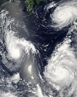
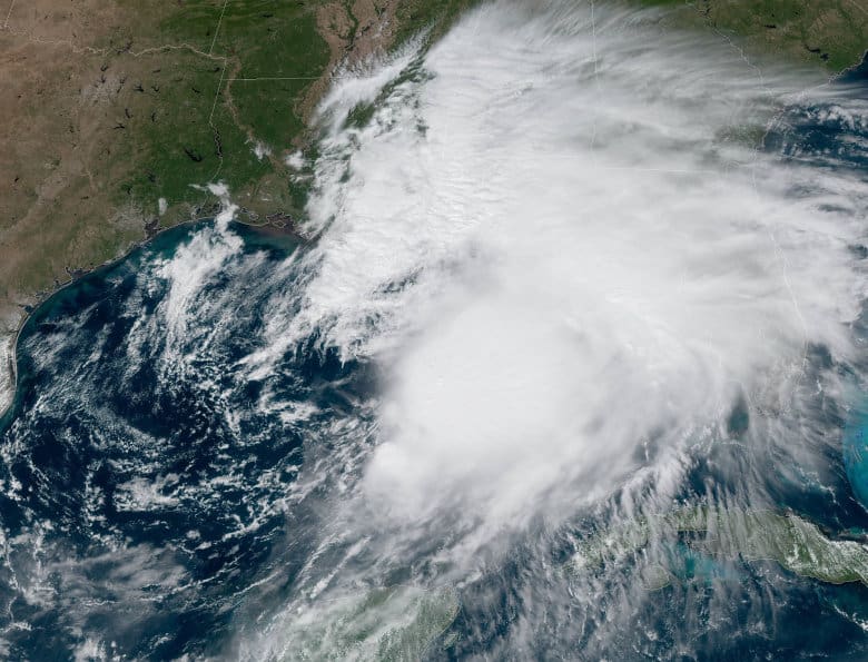
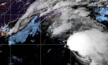
Tropical storms are areas of low pressure with strong thunderstorms that rotate about the center of the storm with sustained wind speeds between 39 and 74 MPH. They have an easily recognized spiral shape when viewed with satellite imagery.
As warm, moist air rises into the storm, it adds energy to the formation and strengthens it. A distinct eye will begin to form and the storm becomes a hurricane when sustained winds exceed 74 MPH. At the same time, the forward movement of the storm slows down which allows it gain more energy from the warm ocean water. Storm bands form the distinct arms of the cyclone’s spiral shape.
Hazards and Effects
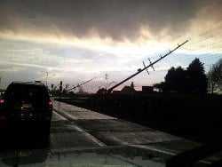
Strong storms wreak havoc on power distribution systems
Hurricanes have sustained high winds that can exceed 200 MPH, with bursts of even higher wind speeds. The high winds push ocean water into a dome-shaped mound called a storm surge that moves with the hurricane and can move onto land with the storm. Hurricane Katrina had a 25-foot surge that overwhelmed the coast of Louisiana and New Orleans in 2005. Flooding from the storm surge and from heavy rains can leave entire communities under water.
The strong thunderstorms within a hurricane and the cyclonic movement of the storm create the perfect environment for the formation of tornadoes once the hurricane reaches land.
Extreme winds and flooding wreak havoc with infrastructure including roads and the electrical power grid. Large storms can leave areas without power for weeks. Portable generator sales and rentals skyrocket as residents scramble to restore power for pumps, refrigerators and heating and cooling. Generator shortages push prices up.
Vulnerability
The entire eastern coast of North America, the Gulf Coast, Latin America, the Bahamas and the Caribbean Islands are vulnerable to tropical cyclones. Long-range forecasters predict a higher than average chance of a major hurricane (category three or higher) making landfall in the United States in 2013.
Off all weather events, a hurricane gives residents in its path the most time to prepare or flee. Forecasters can predict the general path of a hurricane as much as a week in advance and have an accurate landfall target area several days before it hits. Authorities can determine if evacuation is necessary and save lives by moving people out of harms way.
Note: Anyone in the direct path of a hurricane should move inland away from the brunt of the storm.
Those living outside the direct path of the storm can prepare by stocking up on non-perishable food, water, and fuel for portable generators.
Waiting for a hurricane to threaten before preparing is a recipe for disaster. By the time a storm’s path is known, savvy homeowners will have boarded up their homes and made their escape. Those outside the direct path will have generators, food, water, and fuel to help them weather the coming days and weeks.
If you live in area vulnerable to hurricanes, keep a months supply of non-perishable food on hand. When a storm does threaten, fill water containers with at least one gallon of drinking water per person, per day, for at least one week. Additional water is required for washing, cooking, and sanitation. It takes 1.5 to 3 gallons of water to flush a toilet.
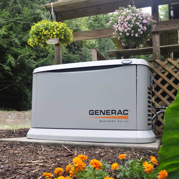
Standby generators make a lot of sense in hurricane-prone areas. They operate automatically and since they use natural gas or LP gas, there’s no need to fill them every few hours with fuel. It takes time to install a standby generator system and most people will need the services of a qualified electrician. Don’t wait for the storm, plan and act now.


