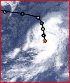
Hurricane Humberto Near the Cape Verde Islands
Hurricane Humberto is the first hurricane of the 2013 Atlantic Hurricane Season. It nearly broke a record for being the latest “first-hurricane-of-the-season” to form in the Atlantic Basin, missing the mark by just three hours.
Higher than usual water temperatures prompted an usually active hurricane season forecast for 2013. Although prior to Humberto there were seven named storms, Humberto is the first that intensified into a hurricane with sustained winds greater than 74 MPH. On average, three tropical cyclones of hurricane strength have formed by the end of August.
Tropical Depressions have sustained winds of less than 39 MPH and are poorly organized. Tropical Storms have winds of 39 to 74 MPH with organized rotation around a central location. Hurricanes are very organized with a defined eye and organized rotation around it.
About 5:00am on September 11, 2013, The National Hurricane Center declared that Humberto had intensified from a tropical storm into a hurricane with sustained winds of 75 MPH. Humberto continues to intensify with sustained winds now reaching 80 MPH.
Threats
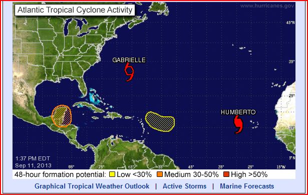
Storm Systems Including Hurricane Humberto and TS Gabrielle
Image via The National Hurricane Center
Currently, Humberto poses little threat to land beyond some heavy rain in the Cape Verde Islands off the coast of Africa. The storm will track mainly north for the next 48 hours, then veer to the west. As it meets dryer air and cooler ocean temperatures, Humberto will subside back to tropical storm status and gain speed. Forecasters at the NHC predict winds will have subsided to just 40 MPH by Monday, September 16.
Meanwhile, Tropical Storm Gabrielle has reformed as it approached Bermuda with winds of 45 MPH. It will continue to track north without gaining significant strength until it declines into a post-tropical cyclone and brings heavy rain and 45 MPH winds to the Canadian Maritimes.
Another system to watch is currently over the Yucatan Peninsula of Mexico and headed for the Southern Gulf of Mexico and Bay of Campeche. Forecasters give this system a 70 percent chance of becoming a cyclone in the next five days.
Storm Preparedness
Any storm can leave residents in large areas without power, and the outages can last days or even weeks while crews struggle to repair the local electrical distribution system. Power outages leave homes without heating or cooling, sump pumps stop working, and food spoils in refrigerators and freezers, not to mention the lack of conveniences.
Store at least seven gallons of water per person for a weeks supply of drinking. Additional stores are needed for washing and cooking. Keep enough nonperishable food for at least week for everyone in the home. Other supplies include batteries for flashlights, fully fueled vehicles, and enough fuel for portable generators to last a week.
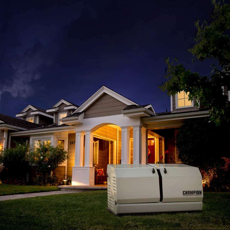
A home standby generator for backup electrical power can eliminate worries about flooded basements, spoiled food, or frozen pipes or unbearable heat. The generators operate with an automatic transfer switch and many models connect directly to the home’s natural or propane gas supply for an uninterrupted supply of fuel.
Portable generators are less convenient and require frequent refueling, but they can keep the lights on and the food cold if properly connected through a manual transfer switch.
Be Ready
Although most tropical cyclones allow forecasters to give some warning before they strike land, storm forecasting is an inexact science. Good storm forecasts are possible 36 to 48 hours before landfall, but beyond that, forecasts are still experimental.
Advance preparation is important. Learn evacuation routes before a storm threatens. If you live on the coast in the path of a hurricane, be prepared to evacuate. Remember that high winds are only part of the danger. Storm surge and inland flooding account for more damage and deaths than hurricane force winds. Monitor local news and forecasts, and be ready to evacuate if the word is given.


